Category Archives: All

TM-4: Ashgabat

No, it's not a prison run by the Ministry of Magic. But it's an equally strange place, the weird capital of the earth's weirdest banana republic.

Ashgabat was a small village in the 19th century at the time the Russians moved in and made it their capital. What the Tsarists built completely collapsed in a giant earthquake in 1948, and the Soviets rebuilt it in their style.
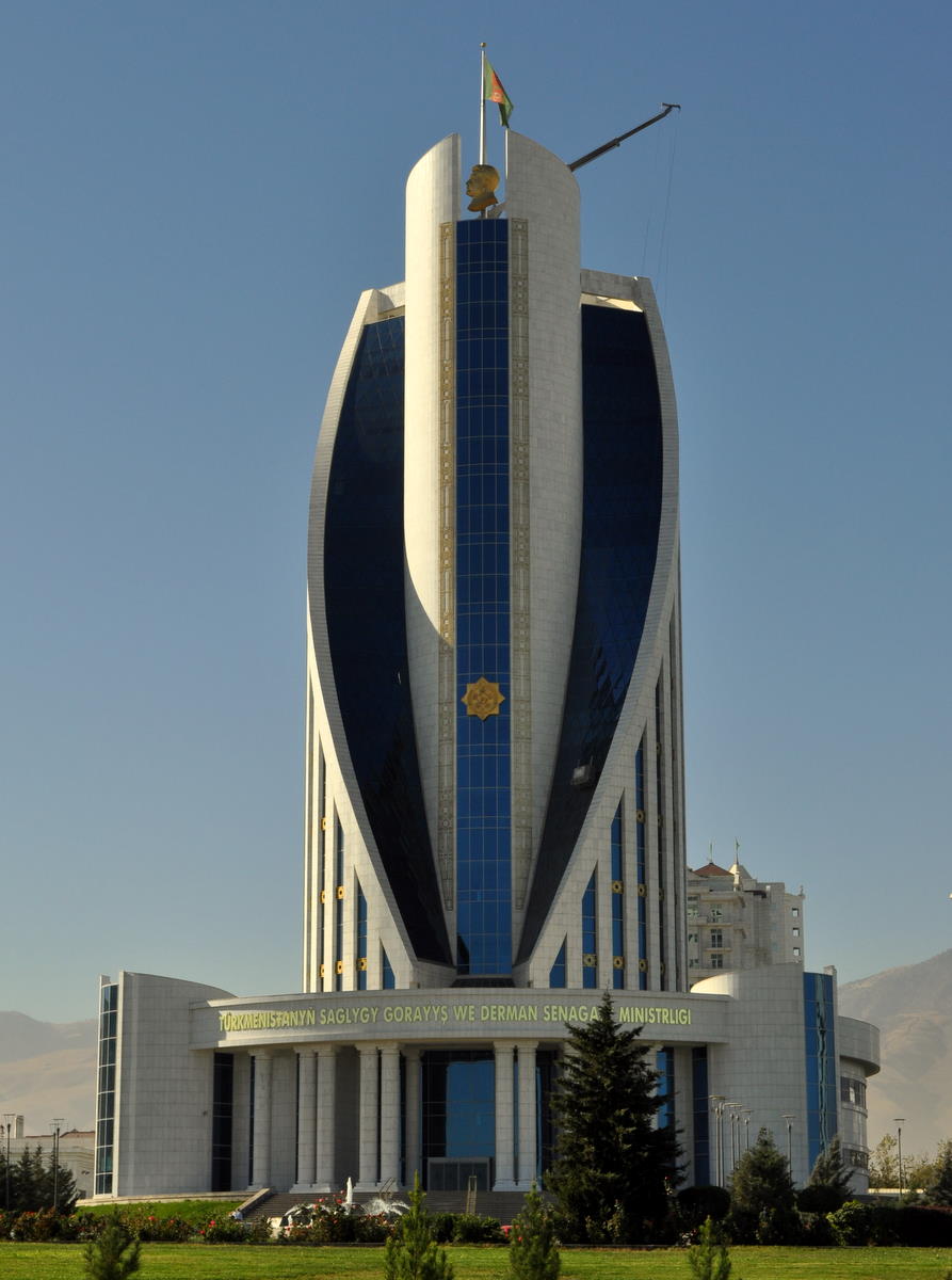
And since 1991, it has been replaced yet again. The first not-quite-eternal President Niyazov declared his reign to be Turkmenistan's “Golden Age,” and he needed a capital to match. Reserving gold for palace domes and statues of himself, he had the rest of the city rebuilt in white Italian marble. As he toured the capital cities of the world, he would see things he liked and build grander versions at home. Thanks to oil and natural gas revenues, money was no object, nor were water or electricity. The world's largest floodlit fountain in the middle of the desert? No problem.

Everything is built in a consistent style by the French construction company Bouygues. That would be wonderful if it actually had style. But it's the cheapest imitation of neoclassical capital architecture. It makes Las Vegas look classy.
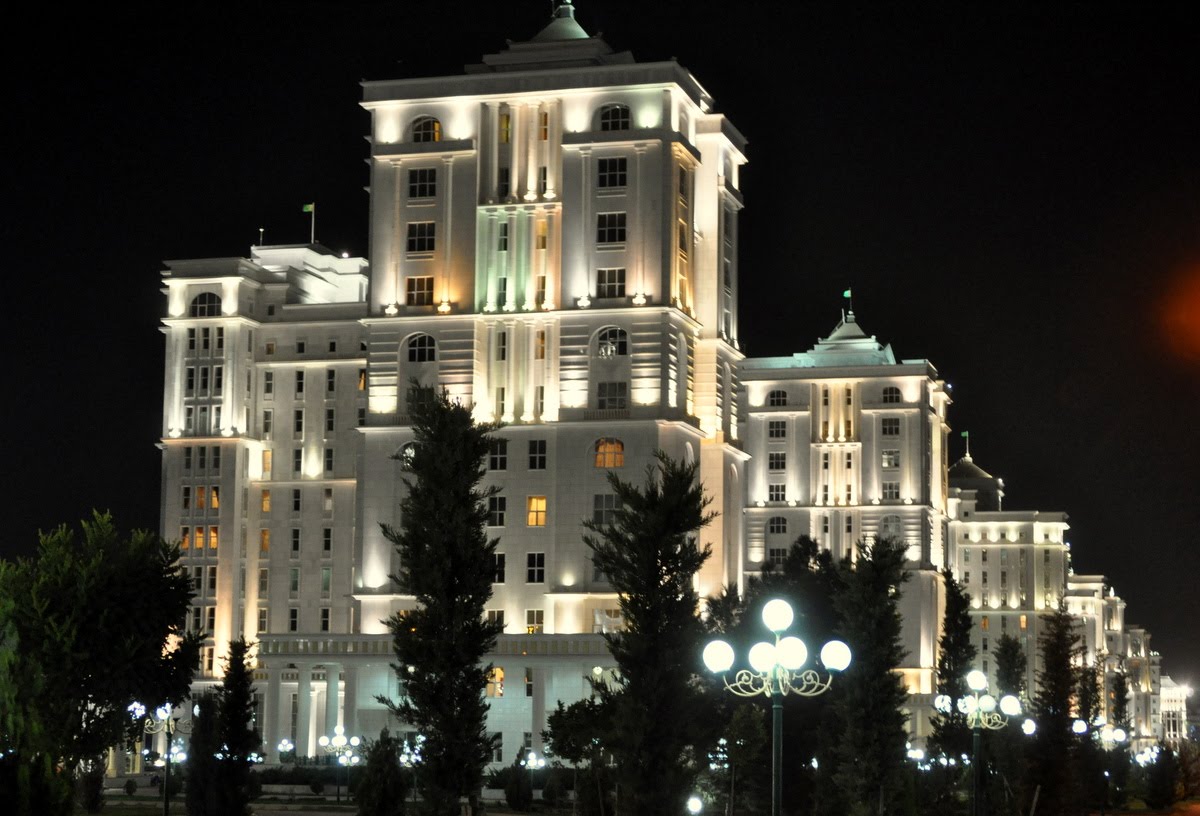
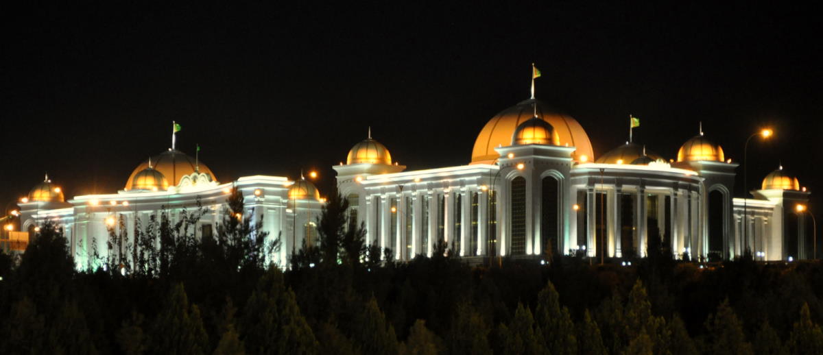
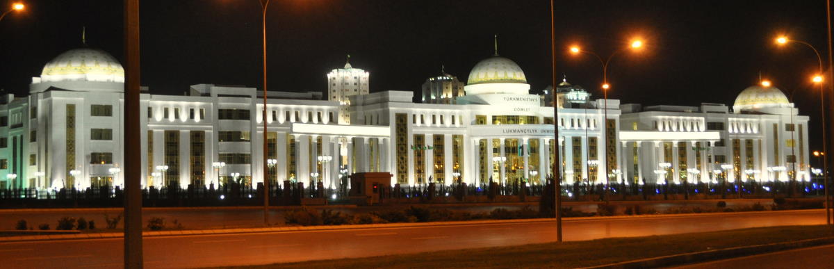

The result is a giant, kitschy capital on a scale exceeding Washington. All this for a poverty-line desert country of 5 million people, smaller than Kunming or the San Francisco Bay Area. Less than a million people live in the capital, and only the corrupt officials of the many ministries can afford the gleaming apartment blocks. The Ministry of Carpets has its own 12-story building.

We stayed at in the “new city” of Berzengi, a Las Vegas strip of 36 hotels and government ministries on the southern outskirts. Our hotel was reminiscent of a medieval castle. The rooms were huge, but completely unmaintained. Water and electricity are free in Ashgabat, so no one worried that they ran continually in our bathroom. No one spoke English and service was non-existent.

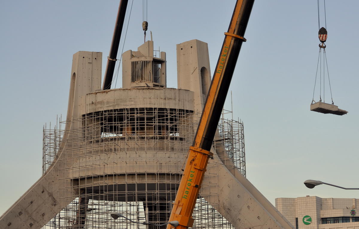
Sadly, we came a month too late to see the greatest monument of all, the Arch of Neutrality, shown in the bus-stop poster to the right. Niyazov built it to commemorate his trip to the UN to declare his country “permanently neutral,” and he crowned the 91-meter (300 foot) tower with a 12-meter gold statue of himself. The statue rotated once a day so that it always faced the sun, or vice versa, as some wags claimed. Alas, President B decided to make his mark this year by tearing down the most visible monument to his predecessor, perhaps sensitive that it was making an international laughingstock of his kingdom. So all we got to see were the cranes removing the final third at its base. No doubt Bouygues was again being paid well for the demolition.

Also under revision is the book-shaped museum of the Ruhnama, the “holy book” that Niyazov wrote to create a mythology for himself and his ex-nomad people. In its day, the Ruhnama was required reading for college entrance and driving exams, but there are rumors it will now be shelved even in elementary schools.

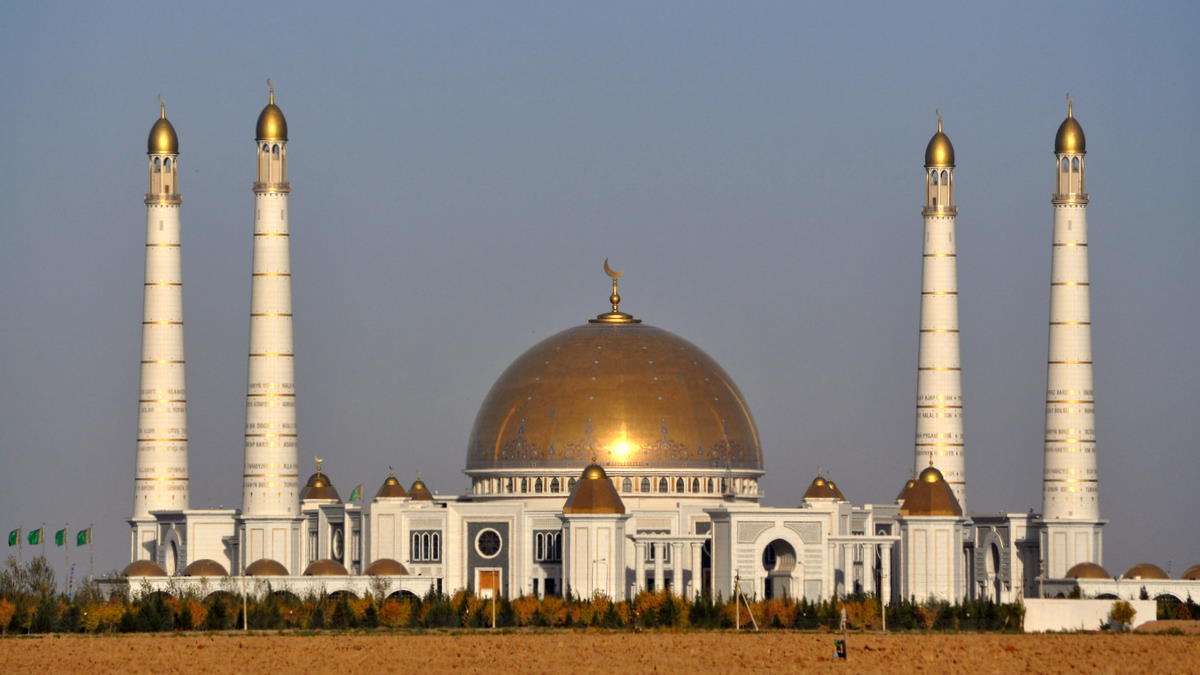
Every visitor must make the excursion to Gypjak, the largest mosque in Central Asia. Built by Niyazov at the village of his birth, it has a huge gold dome and minarets 91 meters (200 feet) tall. 91 is an important number as the year of independence and therefore the start of the Golden Age. To say it's a mosque is stretching Islam: an inscription over the entrance compares the Ruhnama to the Koran.

The one place we did want to go was the National Museum, which has most of the best finds from Merv, Gonur, and other archaeological sites in Turkmenistan. It was indeed a good museum, but somewhat overshadowed by its giant building, which had to be large enough to hold the world's second largest carpet weaved by happy workers in honor of the president (the largest is a similar work in the carpet museum on the other side of town).

The shining capital seemed strangely empty, with more policemen than people walking in the streets. But somewhere there had to be a million people struggling to make ends meet in the hidden underbelly where normal economics still had to apply. Despite free water and electricity given by the government, life can’t be easy for people making only a few hundred dollars per month.

We finally found the people in the giant market that takes place every weekend on the north end of town. A crude city of shipping containers and tarps in the desert, it was the place normal people could go to buy housewares, car parts and sheep. The toilet was the sand dune to the west. But even this bit of reality will soon change, as President B has arranged its imminent relocation to a huge marble-coated hall even further out of town. Prices will no doubt go up.


TM-5: Nissa and Geok-Depe

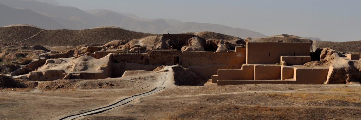
Just outside Ashgabat is the site of Old Nissa, a capital of the Parthian empire 2300 years ago. Mithridates reigned here, and in a celebrated battle in 53 BC, the Parthians' gleaming silk banners so frightened Crassus's Roman army that it was completely defeated. There are tales that the Parthians resettled the captured Romans in Central Asia and later in western China, perhaps the source of some strains of blond hair. Like other ruins, there isn't much left of Nissa, though several walls have been excavated and reconstructed.


Further in the same direction is Geok-Depe, the scene of another battle between the Tsarist forces and a large army of fierce Turkmen defenders. After capturing the fort, the Russians took a page out of Genghis Khan's playbook and slaughtered most of the prisoners, its general saying “the harder you hit them, the longer they will stay down.” The rest of the nomadic Turkmen tribes surrendered quickly and the Russian presence became permanent.

At a farm near Geok-Depe, we were able to see a pair of the famous Akhal Teke horses. At first the owner wanted $50 just to show them, but he quickly backed down when we refused to pay. They are indeed beautiful, tall horses, able to run all day.

TM-6: The Darvaza Gas Crater

In a land of the bizarre, nothing is stranger than this burning crater in the middle of nowhere. Roughly 100 meters (330 feet) across and 40 meters (130 feet) deep, the crater has thousands of burning jets of natural gas seeping up from underground. The flames are strong enough to light and heat the surrounding desert.


No one knows whether the Darvaza Gas Crater is a natural phenomenon or a result of some Soviet-era experiment gone wrong. It shows no signs of explosion or impact, although there are some twisted cables and pipes that were clearly man-made. It has been burning for a long time, although its existence was never acknowledged until the end of the Soviet period.

We are likely to be among the last people who see it. Last year, President B learned about it during a survey of natural-gas installations in the area, and he asked his engineers to shut it down. It's not clear how they plan to do that, but they will no doubt put an end to the fun.

After spending the night at the crater, we continued north across the Karakum Desert. Although its name literally means “black sands,” the color is meant to be taken metaphorically.

TM-7: Konye Urgench

Right near the northern border lies Konye (“old”) Urgench. Once the second-largest city in Central Asia, the capital of Khorezm was destroyed first by Genghis Khan, again by Timur, and finally by the movement of its water source, the Amu Darya (Oxus) River. Most of the inhabitants moved to the new city of Urgench near Khiva, now across the border in Uzbekistan.

Despite its ruined state, Konye Urgench has several amazing monuments. One mausoleum has an almost complete dome of original tile. A 62-meter minaret still stands, the largest ancient structure in Central Asia.


The area has attracted pilgrims for many years. In another not-very-Islamic tradition, women roll down a dusty hill hoping to be blessed with fertility.

After visiting the site, we crossed back into Uzbekistan. The border crossing was much shorter and the baggage checks uneventful. We were back from the twilight zone.

———— end of detailed Turkmenistan postings ————–

Bukhara

250 kilometers west of Samarkand lies Bukhara, another ancient city that frequently shared its history.

Bukhara was an early outpost of Islam, and the religion radiated from there throughout Central Asia. The mystic Sufi branch was particularly important here, with the Naqshbandi sect holding sway thoughout much of the area.

Bukhara had over 100 madrassas and 300 mosques. From the beginning, Islam placed great value in learning, and madrassas (religious schools) are among the most important buildings. The word has recently become associated with fundamentalist indoctrination academies, but most madrassas are just Islamic colleges. Some of the impressive buildings in Bukhara date back to the 15th century.


Although there has been a small religious revival since independence, most of these structures are still unused or converted to souvenir shops. Many smaller madrassas have been renovated into B&Bs with comfortable bedrooms and modern conveniences. We stayed at one with eight rooms and an 18th-century mosque in the back.


Even the more obscure buildings have beautiful features, like this wooden ceiling in a small neighborhood mosque.


The tallest structure in Bukhara is the Kalon (great) Minaret. Built in 1127, it is 47 meters (160 feet) tall with foundations another 10 meters (33 feet) deep. With only minor repais, it has survived earthquakes and Bolshevik air bombings. Even Ghengis Khan left it alone. In addition to its religious uses, the Emir found it a convenient place for executions, dropping prisoners to their death.

Bukhara was also a temporal power superior to Samarkand for most of its history. For the last few centuries before the Russians moved in, Bukhara was the seat of a notorious emir, who capriciously tortured and killed prisoners including two British agents who blundered in. His fortress, the Ark, was a place best avoided.


I gathered my courage and climbed the “water tower,” a decaying Soviet structure in the Registan square opposite the Ark. It seemed solid enough, but I refrained from trying the last external staircase to the top floor. Marcia stayed on the ground and refused to look.

The oldest surviving building is the mausoleum of Ismail Samani, built in 905. The building’s decoration includes suns and other Zoroastrian motifs. By the time of the Mongol invasions, it was covered by dirt and invisible.


Bukhara is known for its medieval markets, built as a series of stone domes. These are now given over to souvenir shops, but still fun to walk through.


Lacking an association with the government’s favorite strongman Timur, Bukhara has seen less reconstruction funds and wholesale rebuilding. As a result, it has a more authentic feeling with occasional locals still using the historic structures. In one neighborhood, a man invited us into his “private museum,” a 19th-century madrassa fallen into disrepair.


We also visited the 19th-century mansion of the first Communist president of the Uzbek SSR. He was hardly a member of the proletariat.


A few kilometers outside Bukhara lies the Bakhautdin Naqshband Mausoleum, the burial place of the founder of the local line of Sufi mystics. Pilgrims come from afar to visit his tomb and to walk around the trunk of an old tree, which supposedly sprouted at a place where Bakhautdin struck his staff on returning from Mecca. This practice is more likely to have come from the local Zoroastrian tradition than from Islam.


Moving around in Central Asia

The roads are much better now that we’re in the plains of Uzbekistan. As in India, taxis are plentiful and cheap, and we sometimes hire a driver for a whole day.

Every car is a potential taxi. Many drivers carry a cheap “taxi” sign that they place on their roof when they want to pick up passengers.

Safety is some concern, though most taxi drivers are very professional. If we’re lucky, there is a seatbelt for the front passenger. Drivers reassure us that we aren’t required to use it, and they carefully avoid using their own outside police checkpoints.

We did have one bad experience with a taxi driver who took us on but then drove unsafely in the opposite direction to drop off some papers to a friend. When this began to take more than five minutes, I objected and we got out of the car to find another cab. Not wanting to lose a fare, the driver threatened the new taxi driver and tried to cut us off when we drove away. I showed my fangs in a way Marcia has never seen, using one of my few words of Russian to tell the driver I would call the police if he didn’t back off.

“Shared taxis” are the best way to move from place to place. One can buy a seat in a car that shuttles between cities for a very reasonable price, since the driver finds other passengers to pay for the return trip. Four passengers plus the driver is considered a full car. For comfort, we often buy all four seats in the car.

Most towns are too small to have regular buses. There are cheap minibus “marshutkas,” but they are very slow because they stop everywhere to let on overweight matrons. Only Tashkent has a subway.

Fuel is expensive and scarce right now. Drivers rarely keep their tank full, preferring to add just enough liters to reach their destination. Although there are some modern filling stations, smaller outfits dispense gas using a bucket and funnel.

There are of course interesting loads. Central Asian people like to sit and drink tea on huge benches. This one is moving to a new home.

Instant millionaire


Most Central Asia countries have reasonable control on their currencies, and their money can be exchanged freely at least in neighboring countries.

Uzbekistan is the exception. Although one of the richer states due to oil revenues, its “president” has opted to use Soviet-style controls to prevent currency from leaving the country. Travelers must declare all currencies when entering and leaving, and trouble awaits anyone trying to leave with more than they brought in.

The result is inflation and a rampant black market. Everyone from policemen to hotel clerks will eagerly change dollars at the street rate of 2200 Uzbek som, almost 40% higher than the banks. Everyone eagerly accepts US dollars as a parallel currency.

In its wisdom, the Uzbek government has refused to print bills larger than 1000 som, about 40 cents in US currency. A cup of tea costs more than that, and people routinely carry big blocks of bills for significant purchases. (Credit cards are rarely accepted, and charges would be converted at the bad official rate.)

In order to buy airplane tickets, I had a trusted hotel clerk change $360 into local currency. I got back a stack of almost a million Uzbek som, carefully counted and stacked. The clerk at the airport counted them again with a machine and added them to a large stack that represented the day’s sales.

Samarkand and Shakhrisabz

If there is a center to Central Asia, it is Samarkand. It was already a thriving city when Alexander marched through, and it has seen empires rise and fall ever since. A main stop on most Silk Road routes, it also felt the wrath of Genghis Khan, who destroyed everyone and everything when he swept through.

What stands now is due to Timur, the 14th-century despot who rose from obscurity to conquer most of the known world. Although he was almost as brutal as Genghis, he carted off an army of artisans from the lands he conquered. He then set them to work on building a capital city worthy of himself, mosques and madrassas that were unequalled in the world. Out of this came the blue-and-sable mosaic style that sets the tone of Central Asia to this day. Descendents such as Ulug Beg added the great Registan square to Samarkand, perhaps the greatest town square ever built. Babur and later descendents took a version of the art to Moghul India.


Timur didn't do anything small. His Bibi Khanum mosque had arches almost 40 meters (130 feet) high, comparable to the highest Gothic cathedrals. Even the Koran stand is taller than I am. Unfortunately, they did not hold up well in the unstable ground and fierce winds of Central Asia. Perhaps his architects, who tended to have a short life span anyway, did only what was necessary to satisfy the tyrant and avoid the executioner.


Soviet archeologists and then even more the independent Uzbeks have thrown so much money into restorations and reconstructions that it's hard to say any of it is authentic. The current Uzbek “president” styles himself an inheritor of Timur's greatness and has made Timur the nationalist hero, even if the old tyrant wasn't Uzbek. Still, even if it's a bit like Disneyland, it is very beautiful.

The most exquisite is a set of tombs built around the one small minaret that Genghis Khan left standing. The “teardrop mausoleum” that Timur built for his favorite niece and sister is the height of medieval tilework. Timur himself is buried on the other side of town under the world's largest piece of dark-blue jade.


Not all of Timur’s legacy was monumental. His grandson Ulug Beg was one of the greatest astronomers of his time, making a catalogue of stars that surpassed anything in Europe. Nothing remains above ground of his great observatory, but archeologists recently found the bottom third of the great sextant that once continued its arc three stories above.

Although the great monuments are impressive, we made a point to get off the beaten track. The old Jewish quarter stands behind a wall of tourist shops designed to convince visitors that all of Uzbekistan is prosperous and modern. But one step through a well-concealed door took us out of this twilight zone into the real neighborhood where unrestored mosques, neighborhood baths and even a synagogue rubbed shoulders with ordinary people's houses. (Central Asia historically had a thriving Jewish community, but Soviet attitudes drove most of it to emigrate to Isreal.)


Nearby a small mosque marks a spot in ancient Samarkand that has seen continual worship since the 9th century.


Ancient Samarkand occupied a hill called Afrosiob to the northeast, and it was rediscovered and excavated over a hundred years ago. A small museum houses the most impressive murals I have seen from the Sogdian period (8th century CE) – better than those in the Hermitage!


We took a 25-kilometer detour to Hoja Ismail, the shrine of the scholar Ismail al-Bukhari, who made the most accurate collections of the hadith, the acts and words of the Prophet Mohammed. Although it is on the site of a tomb dating back to the 9th century, most of the construction is modern. But it is still very beautiful.


We took a day trip to Shakhrisabz, about 100 kilometers south of Samarkand.  A small town today, it was the home of Timur, who left behind some ruins even larger than those at Samarkand.  Since these have seen only minor restorations, we could imagine a real sense of the immensity of the construction.

The largest ruins were from Timur's palace.  In its day, it had an entrance arch over 40 meters (130 feet) high and towers up to 60 meters (200 feet),  almost twice what remains in this picture.


Shakhrisabz also holds Timur's family graveyard, a collection of imposing mausoleums.  Timur built a crypt there for himself and probably rolled in his grave when his people insisted on burying him in Samarkand.

Tajikistan blog

What follows are postings for the two weeks we spent crossing Tajikistan.  In the course of that time, we crossed a small sliver of southern Kyrgyzstan, the high Pamir plateau of eastern Tajikistan, the Wakhan and Panj valleys that form the border with Afghanistan, and the lowland cities of western and northern Tajikistan.  We are now in Samarkand, which will be the subject of other postings.

Although we were driving rather than hiking most of the way, we were equally far from the internet.  So we have assembled all the stories and pictures in one group just as we did for our treks. 

We have again arranged things so that the postings read in order from top to bottom.  Just to make sure, we've added TJ-# to the beginning of each title.  As before, you will probably need to click “Older Postings” at the bottom of the page or use the navigation panel at the right to continue reading through to the end.

TJ-1: Two passes into Tajikistan

We left Kashgar at an absurdly early hour in the morning of September 27. Even our driver was asking why the organizer had told us to leave at 5am when the border wouldn't open for many hours. But it allowed us to stop and get a leisurely bowl of noodles for breakfast.


We first needed to cross back into Kyrgyzstan at the Irkeshtam border post. (Although there is a direct pass from China to Murghab, Tajikistan, it is currently open only to local nationals.) The Chinese border was efficient, though they wanted to look through our bags and pictures to make sure we weren't spies. Our car then took us another four kilometers to the actual border fence, where we had to begin walking. At the bottom of a steep hill was the first Kyrgyz border guard, who packed us in the cab of a Chinese truck to ride the remaining three kilometers to the Kyrgyz border station. We still had to walk the last kilometer, however, because there was a massive traffic jam of trucks waiting to cross. The Kyrgyz police were hardly interested in anything beyond writing down a few numbers from our passports.

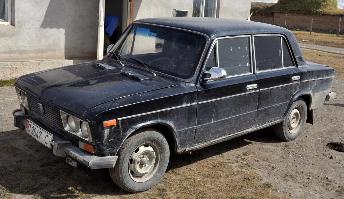
We had arranged for a Tajik driver to meet us at the border post. He was there all right, looking for “Mr. Thomas,” though we were a little worried about his 30-year-old Russian Lauda car that reeked of gasoline. But the car ran and gave us a pretty smooth ride on the recently paved road into the Kyrgyz village of Sary-Tash, where we planned to spend the night. On arrival, we were happy to learn that the Lauda was just a taxi and our Tajik driver was waiting with a Japanese 4-wheel-drive to take us the rest of the way.


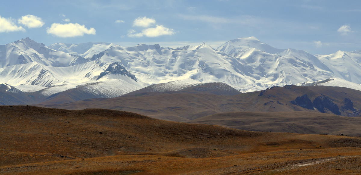
This part of Kyrgyzstan was a wide valley called the Alay, and it gave wonderful views of the first range of the Pamirs, including 7100-meter Pik Lenin. The higher 7450-meter Communism Peak lay beyond in the clouds, which were promising worse weather for the next day. A pass to the north leads across the western Tian Shan mountains to Osh and Jalalabad, the troubled region that we had decided to avoid. The Alay valley runs gradually down into western Tajikistan and eventually the Amu Darya (Oxus) river, but that border is not open to foreigners.


Our path the next morning lay south on the Pamir Highway across the Kyzyl-Art pass into Tajikistan. The Russian military built the Pamir Highway in the thirties and paved most of it in preparation for its invasion of Afghanistan. It has clearly seen no maintenance since independence, because potholes made the paved sections worse than the dirt.

This border crossing into Tajikistan was more painful because with so little traffic the border guards had nothing better to do than make us wait looking for bribes. Our driver, although sullen and taciturn, managed to produce packs of cigarettes at the right time to get us through. It took an hour to get out of Kyrgyzstan and another hour to get into Tajikistan. A drunk policeman demanded to have a seat in our car to the next town, and we couldn't refuse. We got rid of him as soon as we could.

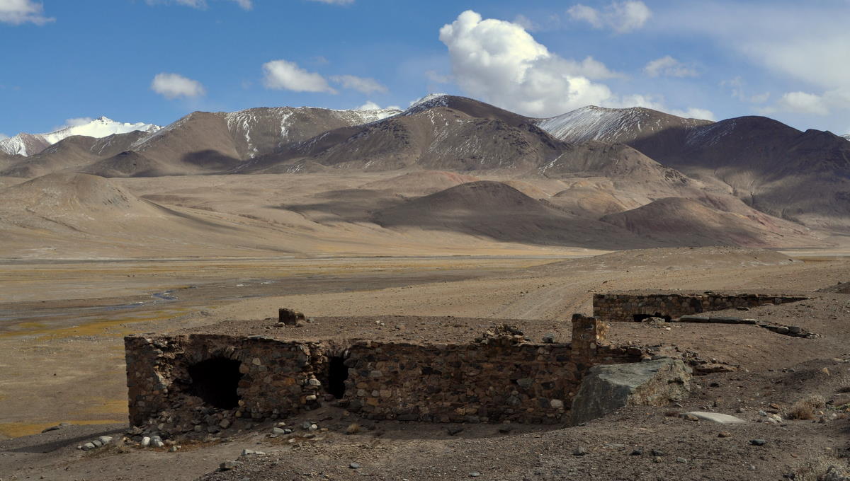
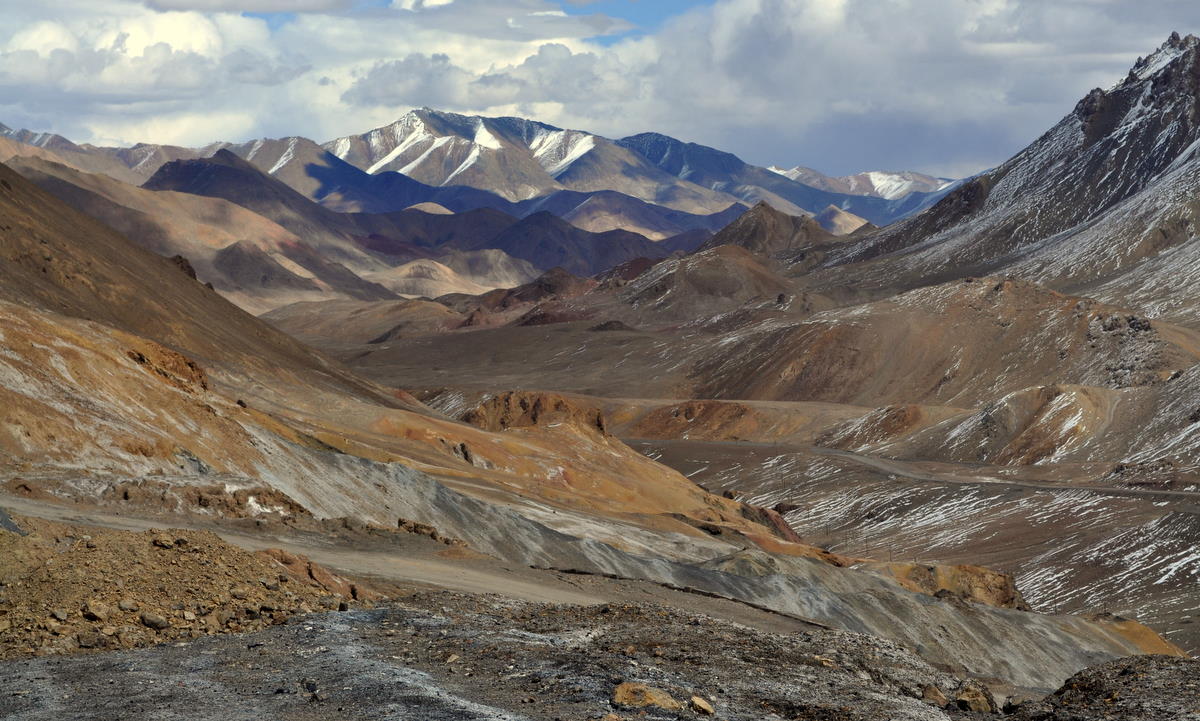
The eastern half of Tajikistan was dominated by the Pamirs, a region of high mountains and wide desert valleys. Most of it was above 4000 meters (13000 feet), and the parallel mountain ranges had snow-covered peaks several thousand meters higher. It was largely uninhabited, but ruins of a caravansarai showed that travelers such as Marco Polo had been crossing this area for centuries. Lakes sometimes formed in the valleys, including the huge turquoise Karakol Lake, which we passed soon after the border.


In a few more hours of driving, we reached Murghab, the only real town in the area.