Category Archives: All

Day 3 – Nov 13 – Around to corner into the glacial valley

We were hoping for better weather, but it was still cloudy with drops of rain in the morning. We arranged plastic bags as pack covers so that our stuff would be better protected, and we set off.

The morning’s scenery was a continuation of the previous day’s deep canyon cutting northward through the mountains. More waterfalls fed the main river. More road construction created detours and blemishes on the landscape.

As usual, we had lunch in a teahouse along the trail. The menus and prices are fixed by the local tourism councils, who train the restaurants on how to cook for Western stomachs. Some dishes are more successful than others. We made the mistake of ordering lasagna today. The result was an overly salty pile of pasty noodles that resembled Chinese stir-fry more than pasta.
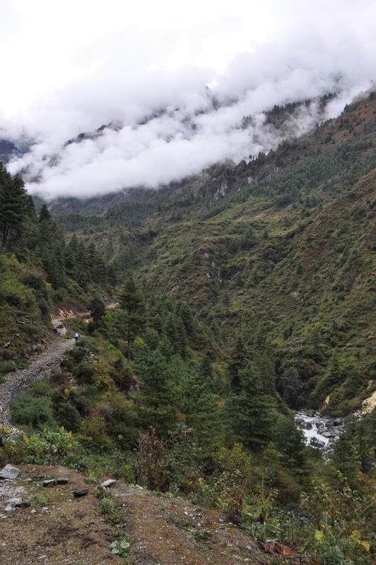
After lunch, the trail turned a corner and began following the east-west valley that will take us all the way to Manang and the pass beyond. This valley has the broader shape of glacial formation, and the wide trail is an easy uphill on what will eventually become the road. We stopped in the mid-afternoon in a town called Donaqyu – another easy day.

The weather was also improving. The rain stopped just after lunch, and by mid-afternoon there were rays of sun. Stars appeared in the evening, so we are hoping for a good day tomorrow.

Day 4 – Nov 14 – Continuing clouds

Today was a short day climbing about 500 meters to the district capital Chame. Aggressive hikers combine this with the previous day, but that makes for a very long day. We are slow hikers and we hope we left the really long days behind in Dolpo.

The weather was better but still cloudy. We could at last see most of the mountains overlooking the valley, but the highest peaks were still in the clouds. That was a shame because we are now getting to the place where we are getting our first good views of Annapurna II and other great mountains. We hope the weather continues to clear.

Along the way we passed a 32 kilowatt micro hydro generator. A number of towns in the Annapurna area have used tourist money to build such projects, which provide local power for lights and other appliances. This is a dramatic change from Dolpo, where the only electricity was from solar panels on top of a house.

Chame was relatively upscale in its accommodations. We had our own little cottage and quite a nice restaurant. There was internet access, although their advertisement of broadband speed was a little excessive. Hot showers, however, were not an option since the solar water heaters had gone for so many days without sun.

Day 5 – Nov 15 – The glacial valley

Today was another gradual climb uphill toward Manang. Sonam had us start early because it was to be a longer day, but we made faster progress than he expected. Although we are still walking slowly compared with the twenty-something trekkers, we have clearly developed some strength and endurance in our previous trip.

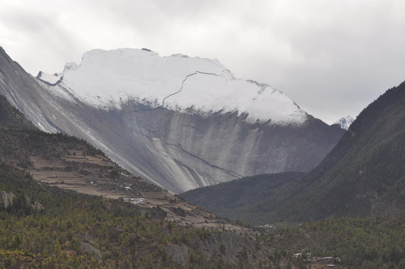
The gorge became quickly narrow just above Chame. At first it was steep cliffs with a gorge cut by rivers into the looser soil below. But after our early lunch, the next bend revealed a huge, glacier-polished slope more than 1500 meters (5000 feet) high. Formed from a single piece of granite, this was a testament to the power of the glaciers that must have once flowed down this east-west valley.


The weather was still not cooperating. Although we got some sun and fleeting glimpses of Annapurna II in the morning, the clouds soon lowered and spit a few drops of rain. The Annapurna range tends to get more weather because it has no front range to protect it from the moist air rising from the Indian plains, but it is not normal to have 5 straight days of clouds in November. We can only hope that it’s not dropping more snow on the pass, which already has a 30 centimeters from the previous storm.

We spent the night in Lower Pisang. The books suggest going across the river to the better views of the upper town, but the lodges there are more primitive and we will only take the high trail if it is good weather in the morning.

At dinnertime, the locals were watching a violent gangster movie on the satellite television, so I escaped to my equally horrifying book about the twists and turns of Nepalese politics and revolutions. It is sad to think that the people living in this beautiful place are subject to such a failed political system that lurches from crisis to crisis under people more interested in winning personal power, money or ideology than in helping their suffering country.

Day 6 – Nov 16 – Up to Manang

Weather was still cloudy when we woke up, so we decided to take the easier lower route. The upper route would have given better views, but clouds look the same from every perspective.

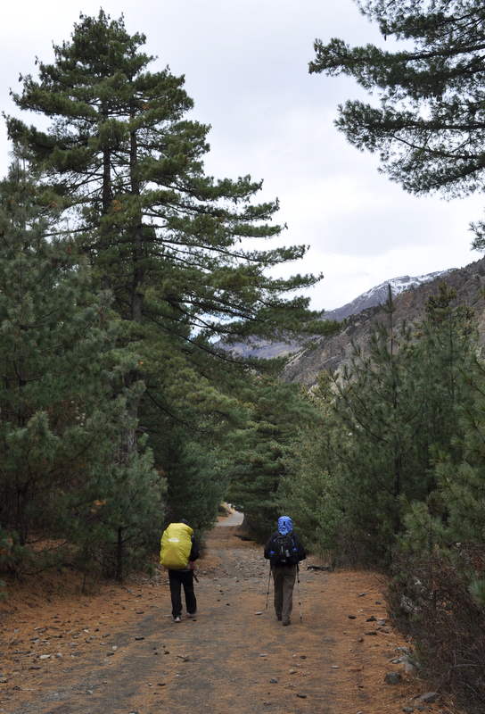
The walk followed the wide Manang valley, so a lot of it was as flat as any trail we’ve seen in Nepal. The forest was mostly pines, so we sometimes thought we were walking in the Sierras.

We had lunch next to the airport, which was humming with flights carrying out groups that had given up trying to cross the pass after the snowstorm. That had us a bit worried, but we soon got word that at least some groups had gotten through.

We arrived in Manang around 2pm after a few more hours’ easy walk uphill. Manang is quite a trekking center, since people normally spend two nights here for acclimatization. Our hotel is three stories high and has great food including yak steaks and oven-baked pizzas. It’s also one of the more expensive places in Nepal.

Most of the conversation at other tables centered around the dangers of altitude sickness and the 5400-meter pass we will be crossing. Most of the young Europeans on this circuit haven’t been much above 3000 meters. For us it’s old hat, though we are still acclimatizing as if this were our first trip, since medical authorities say we may have lost most of our previous acclimatization in the two weeks since we returned from Dolpo.

Day 7 – Nov 17 – Rest day in Manang

Our acclimatization day in Manang was to be devoted to one or two shorter hikes around the town. Being active helps acclimatization as long as one doesn’t push it to the point of exhaustion or illness.

We were also starting to get some better weather. At daybreak at least half of the sky was clear and we could get fleeting glimpses of the summits of Annapurna. On previous days it had clouded up by mid-morning, so we agreed to hike on the north side first to take advantage of the views while they were there.

First, however, I had to treat myself for diarrhea, which had been coming on for days and started in earnest in the night. I began taking Cipro immediately since more than 80% of such cases are e. coli infections, but even Cipro takes about half a day to really kill the cause. In the mean time, the only choice is to make multiple trips to the bathroom, which is not pleasant with Nepali toilets.

Despite all that, we got started uphill a little after 10:00. Our first destination was Praken Gompa, a small mountain monastery about 400 meters up the north side of the valley. It was a pretty steep climb and I was slowed by my illness, but we all finally made it up the hill. The monastery was inhabited only by Lama Tashi and his wife. Lama Tashi is 93 years old and he keeps himself busy giving blessings to travelers who came up the hill. We each went through the ceremony, which consisted of eating a few grains of blessed holy food and oil, and then having Lama Tashi touch our heads with an old book of sutras. Lama Tashi then dexterously tied a small ribbon around our necks, which we were to wear at least over the pass. In response to our questions, he explained that he was now the oldest person in the Manang Valley and he stopped going down the hill to town a few years ago when his legs got too weak. Marcia later spoke with a town health worker who had needed to climb up a few times to treat Lama Tashi – a long way for a house call.

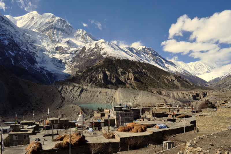
We returned to the hotel for a late lunch, after which Marcia decided she had had enough walking for the day. My medicine was now working, so I went on a short walk across the valley to see the Ganggapurna glacier and the green lake at its toe. Most people go up to a viewpoint with a tea shop, but it was getting cold and I could get just as good a view by scrambling to the top of a moraine partway up. So I took some pictures and headed back to town, stopping at the small Manang Culture Museum to admire some festival masks on the way back to the hotel.

Day 8 – Nov 18 – Leaving the Manang valley

We left Manang this morning and began heading toward the pass.

The weather was sunny except for the banner clouds formed by the jet stream blowing across the highest summits at maybe 200 kilometers per hour. We felt fortunate that the storm had cleared just as we were beginning the most spectacular and difficult part of the trip. Earlier groups had crossed the pass in clouds or worse.

Today’s climb was a reasonable 400 meters, prolonged only by my constant stops to take pictures of Annapurna II, III, IV, Ganggapurna, the Great Barrier, and Tilicho Peak, which were all laid out in increasing grandeur as we climbed. The trail left the Manang Valley and headed north towards Thorong La pass, which we will cross in two or three days. By the end of the day we could see the pass and the two large mountains on either side.

Just before our stopping place, we saw the first yaks of this trek. They were no surprise to us but a big thrill for the first-time travelers. One woman told us she had been waiting all her life to see a yak.

We read books for the rest of the afternoon and listened to the talk of others in our hotel. One rather tiresome Canadian was telling everyone about how he had flown into Manang and was hoping to do the pass in another two days, his dream since an earlier trip when he had needed to turn back because of altitude sickness. Judging from his labored breathing and overly aggressive schedule, he was well on the way to the hospital again, and he was committing the big mistake of traveling alone. I hope he makes it to the top, but if he doesn’t, he will have endangered not just himself but also the other people who will need to help him get down.

Day 9 – Nov 19 – High camp toilets

Today we moved up the valley toward the pass. In the morning, we climbed about 500 meters and reached the lodges at Thorong Phedi, where we had lunch. In Nepali, phedi means the foot of a pass, and it’s really true here, as this marks the beginning of the big climb out of the valley.

There are two sets of lodges on this side of the pass. The books recommend staying at the large lodges at Thorong Phedi, since they are more comfortable and at a more reasonable altitude. We had decided, however, that if we were feeling well we would keep moving up to the smaller lodge at High Camp 300 meters above so that we could get an early start and cut down on the long day tomorrow. Unfortunately, many others had the same idea and we were lucky to get the very last room.

My next adventure was self-inflicted. Lodge toilets are of the squatter type, and they have a bucket of water next to them for some semblance of flushing. I was curious whether the water was still frozen in the mid-afternoon, so I reached in my pocket and pulled out my flashlight. Something dropped out and fell straight into the toilet, jingling right down the drain. I then remembered that I had put the key to the padlock on our room in the same pocket, and it was now long gone.

The locals were very amused when I confessed, but they said that they had no spares. About six people came to the toilet to shine flashlights down and they quickly concluded that I was right – no chance of fishing it out. Someone then appeared with a plastic bag of about 300 unmarked keys. Apparently they did have spares but they were not organized. The hotel man began trying keys in the padlock on our door and amazingly the fifth one worked. We were all relieved that we didn’t have to saw off the lock, whose maker incidentally was Godly.

Day 10 – Nov 20 – Over the Thorung La

We woke up at 3:30 because Sonam wanted us to start before daybreak to get to the pass before the winds started up. Thorong La overlooks the Kali Gandaki valley and it gets strong southerly winds after 10am when the warm air from India begins rising through that big gap to blow towards Tibet.

We left the High Camp and its frozen toilets at 5am and hiked the first hour in darkness with our headlamps. The slog to the pass was long but an easy trail, especially near the top where the terrain evened out. Like several of the easier passes in Dolpo, Thorong La had been carved by a glacier and was really just a flat wide place at the top. We had a cup of tea at the overpriced shop at the pass.

We knew that coming down would be the hard part, because we had to drop 1700 meters (5500 feet) to the first real lodging at Muktinath. After some initial gradual descent, the trail began dropping sharply. Each pitch got longer and steeper until we were descending several hundred meters at a time. The trail remained snowy most of the way down, and there were some tricky icy patches near the bottom. I fell once, as did Sonam, but no one was hurt. Marcia’s knee was quite painful due to all the steep descents, but still better than coming out of Dolpo.

The steepest part ended at a lunch place, and it was more gradual after that. A suspension bridge and some chörtens heralded our entry into Muktinath. Because we were so tired, we agreed to bypass the temple complex and return in the morning.

Our hotel had a shower with gas-heated water, which seemed like heaven after 10 days on the trail. Until then, all the lodges used solar power to heat their water, which meant cold water when it was cloudy. Marcia and I opted to stay dirty, but now it felt great to get clean.

Day 11 – Nov 21 – Muktinath and Jomsom

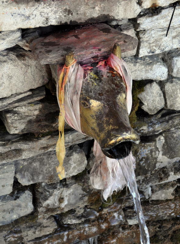
We visited the Muktinath temple complex after breakfast. Muktinath is an ancient pilgrimage site for both Hindus and Buddhists. It is built around a set of springs that are the source of one of the two rivers that form the Kali Gandaki when they meet in the valley below. The waters have now been harnessed into a series of 108 spouts with the head of a sacred cow. Another temple has a fire burning right above the water and its stone floor, bringing together the three most basic elements. Our porter Kichiri is very devout and he managed to put his head under all 108 spouts in the freezing water. He gave us each a ribbon that he had soaked in the holy water.

The new jeep road has dramatically changed the next part of the trek from Muktinath to Jomsom and on down the Kali Gandaki valley. Purists still walk alongside the rumbling jeeps, but it didn’t look like fun in all the dust, and Marcia needed to save her knees from another 900 meters (3000 feet) of descent today and another 1600 meters (5000 feet) tomorrow. So our plan was to take jeeps for the next two days.

The jeep wouldn’t leave until it had 12 riders, so we really packed ourselves in. Sonam arranged for Marcia and me to sit in the front with the driver, which protected us somewhat, but we still had to endure a chatterbox American who was spent the whole trip telling some Israeli fellow travelers about her horoscope and her favorite vampire movies.

Jomsom seemed very different from the previous time, when we were arriving exhausted from a different century. This time we too were relatively clean and accustomed to the guesthouse experience, right down to knowing the menu of approximations of Western food (don’t order lasagna!). We could also walk and climb stairs without great pain.

As in Manang and Chame, I got on the internet and sent a few emails and made interim blog postings. But with high prices, slow connections and poor equipment in these mountain cybercafés, I decided to wait until Pokhara for any further updates after today.

Day 12 – Nov 12 – Bus down the Kali Gandaki valley

It was a bit of a shame to take the bus down the Kali Gandaki valley, bypassing interesting towns like Marpha and Tukuche, but it saved about three days of walking in an area with unpleasantly high winds, allowing us to get back on the real trails sooner, hopefully before the Annapurna Sanctuary gets closed by winter snows. I hope we can come back sometime, maybe as part of a trip to the restricted area of Mustang.

In Marpha we were able to get off the bus for a few minutes while the driver took a break. Marpha looks like a fascinating place, with narrow streets and a huge monastery.

Tukuche looked interesting both for its history and its close views of Dhauligiri. It was here that an eccentric Japanese Buddhist monk named Ekai Kawaguchi spent almost a year in 1899 pretending to be Tibetan before he ultimately made it into Tibet in search of Sanskrit manuscripts. It was also here that Maurice Herzog based his 1950 expedition that made the first ascent of Annapurna.

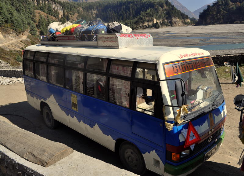
In Ghasa further down the valley, we needed to change buses. The first bus was full and there were not enough people for a second bus. But by gathering a few Westerners and a few porters, Sonam was able to find enough business to convince the driver to make the trip.

We got off the bus in Tatopani, which means hot water. This town is famous for a well-developed hot spring with two pools alongside the river. We joined a crowd of about 30 people taking a dip, though most of the young people seemed more interested in partying and hanging out.

We restocked our supply of books so that we’d be ready for another 11 days on the trail.