Category Archives: Himalayas

Run-in with the law (no photos!)

One mostly amusing sidenote happened on my first morning in Kathmandu, which was also the first day of the general strike.

I woke up early and took a walk around town. On the corner coming into the tourist area, there were about 20 Nepali policemen in riot gear. Thinking this might make a good blog posting, I discreetly took a long-distance picture from way up the street. I then started on my way not thinking anything of it.

As I walked, one of the policemen came over to me saying that photos were not permitted at that spot. It wasn’t that they minded getting photographed (Nepali soldiers typically seem to like posing for photos), but for what was behind them. I should have known from all my previous visits that that was none other than the US Embassy.

I said of course I would delete the photo, but he said no don’t do that. You need to see our commanding officer. So they ushered me into a room inside the embassy and began to take an “incident report.” They said I shouldn’t worry, it happens all the time, but they were certainly thorough, taking flash pictures of me, my camera, the offending picture, and so on. After a call to their supervisor, they told me I could go. But I can only imagine it would have been a lot harder if I had had another country’s passport!

Needless to say, they had me delete the picture from my camera, and I didn’t take another.

Crossing roadblocks to go trekking

I’m not sure how much Western media has reported of the current events in Nepal, but some of you have probably heard about the general strike that has been in effect since yesterday, the day we arrived in Kathmandu. The Maoist party (formerly revolutionaries and more recently part of the government) were forced out of the government last May amid bitter recriminations. Since then, they have been calling periodic strikes, some of which we had to avoid during our last visit.

The Maoist party has used the symbolic May 1 as a rallying point for their cause. As many as half a million people have gathered in Kathmandu for rallies and potential political action. It is hard to tell how many really believe in the cause, as there are reports that some participated because they felt they had to or just to get a free bus ride to the capital. But regardless, the Maoist leadership is determined to shut down the country until the current prime minister resigns and allows them back into power.

The protests have been peaceful so far, but the normally throbbing commercial areas are almost dead. Some shops are open but almost closed to the street, since the shopkeepers need to close the gates in a hurry whenever a crowd of Maoists come by. The main danger is extortion – the Maoists fund their cause by asking each shopkeeper to give a “donation” of a few thousand rupees ($40 in the US, but big money in Nepal). In a way, the tourist areas were more liveable without all the honking cars and hawkers, but it is obviously not a good scene.

So what about our trek? It was pretty tricky since we had to get permits and it wasn’t clear the government offices would open. But open they did and our organizer triumphiantly returned with all the permits two hours before our flight to Pokhara, the second city of Nepal and a way station on our way back to Jomsom, described in earlier blogs.

How to get to the airport when all roads are blocked and no vehicles are on the street? Nepal has been coping with this mess for so long that it has developed alternative realities that sort of work. The Maoists have no intention to disrupt the tourist trade, the lifeblood of the country and a good source of income for many of their followers. Blocking the airport Bangkok-style would accomplish nothing except antagonizing the world. So the Maoists permit buses marked “Tourists only” to pass through the roadblocks. The airport itself was operating almost normally except for the masses of people trying to find transport in to their hotels.

Our transport to Kathmandu airport was in a rattletrap old bus from a shared bus stand set up on the edge of the tourist district. There were of course not enough buses and it was therefore packed, but it got us there quickly on the streets that would have been jammed with traffic on any normal day.


Arriving in Pokhara, our guide Kinna Sherpa found one of his friends in an army uniform and got him to take us into town in an army truck. Pokhara is small enough that we actually could have walked it in about an hour, but that’s no fun with luggage.

In the morning, we’ll get up at 5:00 to get transport before the morning strike starts. With any luck, we’ll be on the first flight to Jomsom and walking from there on with little effect or knowledge of whatever might be happening in the cities. At the end of the month, we travel directly from Pokhara to Delhi, so we shouldn’t even need to leave the airport in Kathmandu. So please no one worry – we’re experienced and we know how to stay out of trouble.

Assuming we do get on the trail tomorrow, we may not have any more posts for a while. But rest assured, no news is good news.

Full postings for our Annapurna trip

As I promised in my interim postings, I have finally pulled all the text and pictures together to tell the story of our trek around Annapurna and our subsequent travels to Chitwan and Kathmandu. As with Dolpo, these postings cover many pages for those wishing to read them.

The notes go back to November 6, the day we returned from Dolpo to Kathmandu. Although they are all posted with today’s date, I have arranged them to display in chronological order. To see all the entries, you will have to click the “Older Posts” link when you reach the bottom of each page.

Overall, this was a much easier trip than Dolpo, as we could eat and stay in local guest houses, usually in private rooms. Marcia and I stayed healthy throughout except for one bout of intestinal trouble and a head cold I brought from Kathmandu. We both lost weight and now feel strong enough to climb Mt. Everest, which we actually did several times over in the course of our travels.

The Annapurna circuit is justly famous, as its spectacular scenery covers a huge variety of terrain from jungles to alpine passes. It is a well-inhabited area with plenty of services and local activity. It offers views of the many peaks of Daulighiri and Annapurna, the seventh and tenth highest mountains in the world.

Over 25,000 people follow the Annapurna trek each year, which means a lot of fellow travelers. We tended not to socialize much with the younger crowd, but it was instructive to encounter dozens of languages and cultures from around our very large globe. Most were European, especially French, who seem particularly fond of using their long vacations following in the footsteps of Maurice Herzog. But there were many other nationalities, from Russian to Australian to Chinese to Thai and Malaysian. Americans were a very small minority, I guess because the only people with enough money these days don’t have time to make such a long trip.

We hope you enjoy the pictures as much as we enjoyed taking them.

Nov 6 to 10 – Recovering in Kathmandu

The five days we spent in Kathmandu were mostly devoted to recovery. We slept long, ate lots of Italian and Indian food and did very little. Marcia went to the spa at the Hyatt Regency, a little bubble of the western world on the edge of town.

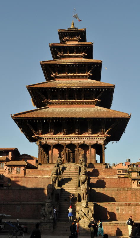
We did make a one-overnight outing to Bhaktipur, an old restored city about 12 kilometers from Kathmandu. Historically there were three cities that made up the Kathmandu Valley. Kathmandu and Patan are quite close and now almost merged into a single city. But Bhaktipur, at the other end of the valley and on the trade route to Tibet, was left relatively untouched until the 1980s, when a German group helped restore it and put in a modern sewage system. The result is a kind of working museum city with some of the best temples and monuments in Nepal.

On our very first night back, we had dinner with Sange Sherpa, the guide who had led us on an 18-day trek to the Everest region in 1999-2000. He is now running a pizza parlor in Barcelona and married to a Spanish woman named Merse. They were back to repeat their wedding celebration in his village in eastern Nepal. Sange is a really interesting fellow who now speaks four languages fluently. We were one of his first clients when we met him at the mountain airport ten years ago. His brother Ngima organized the Dolpo trek for us.

Before long, we had gathered enough strength to start talking about and planning our next trek to the Annapurna region. We considered proposals from both our Dolpo guide Kinna and our cook Sonam, who also does guide work. It was a difficult decision because we liked both of them, but we ultimately chose Sonam, who was more organized and had a really good bond with Marcia.

Just after we locked in our departure date as November 11, I came down with the worst allergy and asthma attack I’ve had in years. For two days I sneezed and coughed so badly that I feared I would be in no condition to hike. But we had set wheels in motion that were hard to stop, so we continued with our plan. Fortunately, I found the right combination of medicines and was able to get things under control just as I was packing.

Day 1 – Nov 11 – Buses, jeeps, and footpaths

We got up at 3:45 because we had to be on the road by 4:30 to avoid a political action by the Maoists, who had scheduled a one-day blockade of all roads in and out of the Kathmandu Valley. Negotiations to bring these former rebels into the political system are going badly, and the Maoists decided it was time to do a show of strength as a threat of worse if they did not get their way. We had to be well outside Kathmandu before 6am.

The roads, which are never good, were particularly congested as other trucks and buses tried to get through before the witching hour. But we finally made it out to central Nepal and began counting the kilometers towards Pokhara. With about 50 to go, we branched off and went up a side road to Besi Sahar, the traditional beginning of the Annapurna loop trek.

After an early lunch, we changed to a Jeep and continued up the new road that is under construction and already filled with ruts. This road is both a blessing and a curse. It will bring electricity, food and medicine to the people of the Manang valley. But it will also change and mostly eliminate one of the most popular remote treks in Nepal and all the business that comes with it. Trekking companies are already looking for alternatives that will be necessary in a few years.

For us, it allowed us to compress the first two days of lowland walking into a couple of hours. We got out at the first rockslide blocking the road and walked about two hours to a nice guest house, where we had dinner and spent the night.

Already Marcia and I are more comfortable than we’d ever been in Dolpo. No matter how many times the staff bring us cups of tea, a tent is still a tent. Annapurna guest houses (sometimes called teahouses) have had forty years to develop into the most advanced accommodations in the Himalaya. By staying and eating in these, we can travel with only light baggage and a minimal staff.

Our staff consists of only two people. Sonam is our guide, who keeps us on the right track and negotiates with the teahouses. 19-year-old Kichiri Sherpa is our porter, carrying both of our backpacks and his own minimal gear. Kichiri has not yet filled out to the broad dimensions of his fellow villagers, but he seems fine with carrying a load that weighs as much as he does.

One could argue that a guide is unnecessary in a well-known area like this, but at $10 per day, it’s nice to have a communicator and friend on the trip. Many of the young trekkers here carry their own packs, which strikes us as a hard way to save a little money. We only wish we could have a porter for our next trip to the Sierras.

My allergies and asthma have had a miracle cure now that we are on the road. I must have been reacting to one of the many substances in Kathmandu’s polluted air, so a change of scene has done me good. Although I’m still coughing a bit, it is not going to interfere with our trip.

Day 2 – Nov 12 – Waterfalls and road construction

Our first full day of hikng up the valley dawned cloudy. Fearing rain, I asked Sonam to by some plastic to cover the backpacks. He didn’t believe it would rain since Novembers are almost always good weather, but he did as I asked.

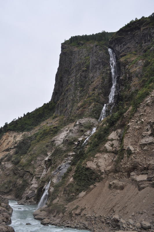
The trail followed a gradual course up the river that we will be following for the next week. There were many high waterfalls from streams entering the valley.

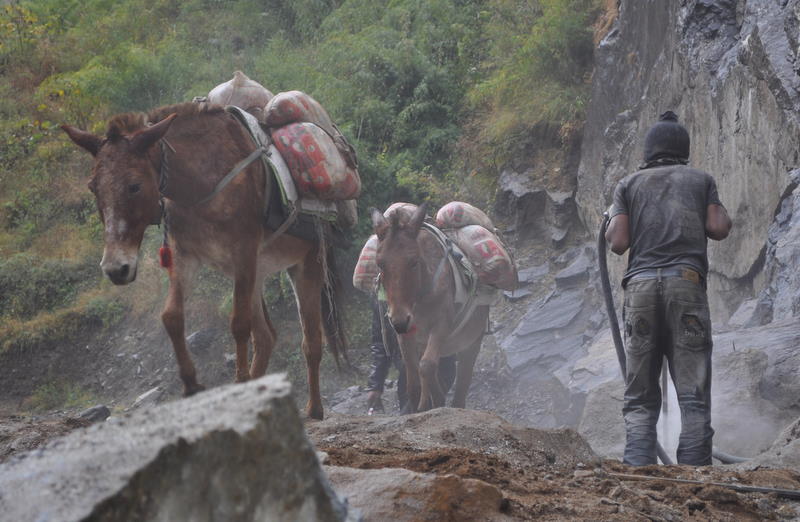
Road construction was also a constant presence, as the workers tried to push the jeep road up a seemingly impossible canyon. Their approach seems to be to brutally blast away any outcroppings in their way, which will leave an unsightly and unstable slope ready to slide across the road with every monsoon. We had to hold up for a few minutes while they set off a huge explosion across the valley. At other locations, they use a combination of power and hand tools, with an army of workers to throw rocks down the slope. Mules walk calmly past the jackhammers.

Sure enough, it began to rain a little after lunch, first on the mountaintops, then a few drops on the train, and then more steady rain. By the time we reached our stopping place in the middle of the afternoon, our jackets were soaked, more from sweat on the inside than from the rain.

We spent the night in a town called Tal, which took its name from the lake that used to fill the wide valley. The lake is gone but a wide, braided river remains on the broad gravel floor.

Day 3 – Nov 13 – Around to corner into the glacial valley

We were hoping for better weather, but it was still cloudy with drops of rain in the morning. We arranged plastic bags as pack covers so that our stuff would be better protected, and we set off.

The morning’s scenery was a continuation of the previous day’s deep canyon cutting northward through the mountains. More waterfalls fed the main river. More road construction created detours and blemishes on the landscape.

As usual, we had lunch in a teahouse along the trail. The menus and prices are fixed by the local tourism councils, who train the restaurants on how to cook for Western stomachs. Some dishes are more successful than others. We made the mistake of ordering lasagna today. The result was an overly salty pile of pasty noodles that resembled Chinese stir-fry more than pasta.

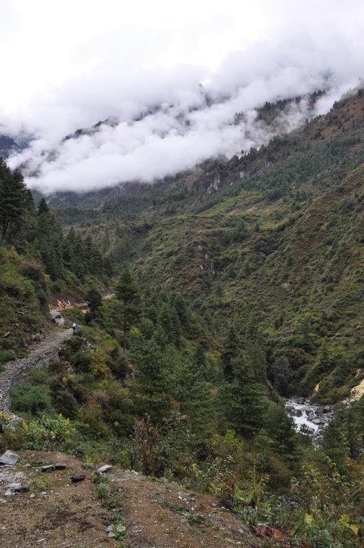
After lunch, the trail turned a corner and began following the east-west valley that will take us all the way to Manang and the pass beyond. This valley has the broader shape of glacial formation, and the wide trail is an easy uphill on what will eventually become the road. We stopped in the mid-afternoon in a town called Donaqyu – another easy day.

The weather was also improving. The rain stopped just after lunch, and by mid-afternoon there were rays of sun. Stars appeared in the evening, so we are hoping for a good day tomorrow.

Day 4 – Nov 14 – Continuing clouds

Today was a short day climbing about 500 meters to the district capital Chame. Aggressive hikers combine this with the previous day, but that makes for a very long day. We are slow hikers and we hope we left the really long days behind in Dolpo.

The weather was better but still cloudy. We could at last see most of the mountains overlooking the valley, but the highest peaks were still in the clouds. That was a shame because we are now getting to the place where we are getting our first good views of Annapurna II and other great mountains. We hope the weather continues to clear.

Along the way we passed a 32 kilowatt micro hydro generator. A number of towns in the Annapurna area have used tourist money to build such projects, which provide local power for lights and other appliances. This is a dramatic change from Dolpo, where the only electricity was from solar panels on top of a house.

Chame was relatively upscale in its accommodations. We had our own little cottage and quite a nice restaurant. There was internet access, although their advertisement of broadband speed was a little excessive. Hot showers, however, were not an option since the solar water heaters had gone for so many days without sun.

Day 5 – Nov 15 – The glacial valley

Today was another gradual climb uphill toward Manang. Sonam had us start early because it was to be a longer day, but we made faster progress than he expected. Although we are still walking slowly compared with the twenty-something trekkers, we have clearly developed some strength and endurance in our previous trip.

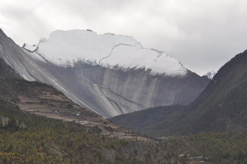
The gorge became quickly narrow just above Chame. At first it was steep cliffs with a gorge cut by rivers into the looser soil below. But after our early lunch, the next bend revealed a huge, glacier-polished slope more than 1500 meters (5000 feet) high. Formed from a single piece of granite, this was a testament to the power of the glaciers that must have once flowed down this east-west valley.


The weather was still not cooperating. Although we got some sun and fleeting glimpses of Annapurna II in the morning, the clouds soon lowered and spit a few drops of rain. The Annapurna range tends to get more weather because it has no front range to protect it from the moist air rising from the Indian plains, but it is not normal to have 5 straight days of clouds in November. We can only hope that it’s not dropping more snow on the pass, which already has a 30 centimeters from the previous storm.

We spent the night in Lower Pisang. The books suggest going across the river to the better views of the upper town, but the lodges there are more primitive and we will only take the high trail if it is good weather in the morning.

At dinnertime, the locals were watching a violent gangster movie on the satellite television, so I escaped to my equally horrifying book about the twists and turns of Nepalese politics and revolutions. It is sad to think that the people living in this beautiful place are subject to such a failed political system that lurches from crisis to crisis under people more interested in winning personal power, money or ideology than in helping their suffering country.

Day 6 – Nov 16 – Up to Manang

Weather was still cloudy when we woke up, so we decided to take the easier lower route. The upper route would have given better views, but clouds look the same from every perspective.

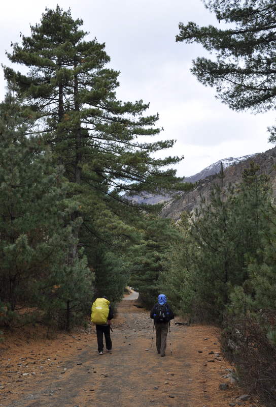
The walk followed the wide Manang valley, so a lot of it was as flat as any trail we’ve seen in Nepal. The forest was mostly pines, so we sometimes thought we were walking in the Sierras.

We had lunch next to the airport, which was humming with flights carrying out groups that had given up trying to cross the pass after the snowstorm. That had us a bit worried, but we soon got word that at least some groups had gotten through.

We arrived in Manang around 2pm after a few more hours’ easy walk uphill. Manang is quite a trekking center, since people normally spend two nights here for acclimatization. Our hotel is three stories high and has great food including yak steaks and oven-baked pizzas. It’s also one of the more expensive places in Nepal.

Most of the conversation at other tables centered around the dangers of altitude sickness and the 5400-meter pass we will be crossing. Most of the young Europeans on this circuit haven’t been much above 3000 meters. For us it’s old hat, though we are still acclimatizing as if this were our first trip, since medical authorities say we may have lost most of our previous acclimatization in the two weeks since we returned from Dolpo.