This day made up for having to change our plan.
Below Photoksar there are two routes. Like almost everyone, we had come on Day 12-13 over the less direct route driving up the new road and then crossing the Sirsir La. Despite the pass and the longer distance, that normal route is easy, even for our pathetic donkeys. In fact, the road will cross this route by the end of this year once they fill in a bunch of washouts.
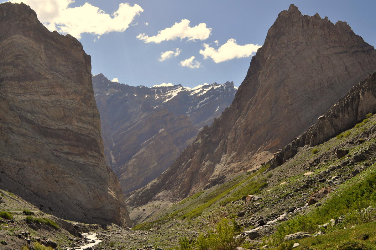
But there is another secret route that only locals seem to take. Just below the village, the Photoksar creek joins the water coming down from Sengge La and enters a long, narrow canyon that eventually comes out at the road. Until a few years ago, the trail was very bad, but it had recently been improved with bridges and ledges through the narrow parts. So we could go straight down the canyon while our animals and luggage went back over the pass.
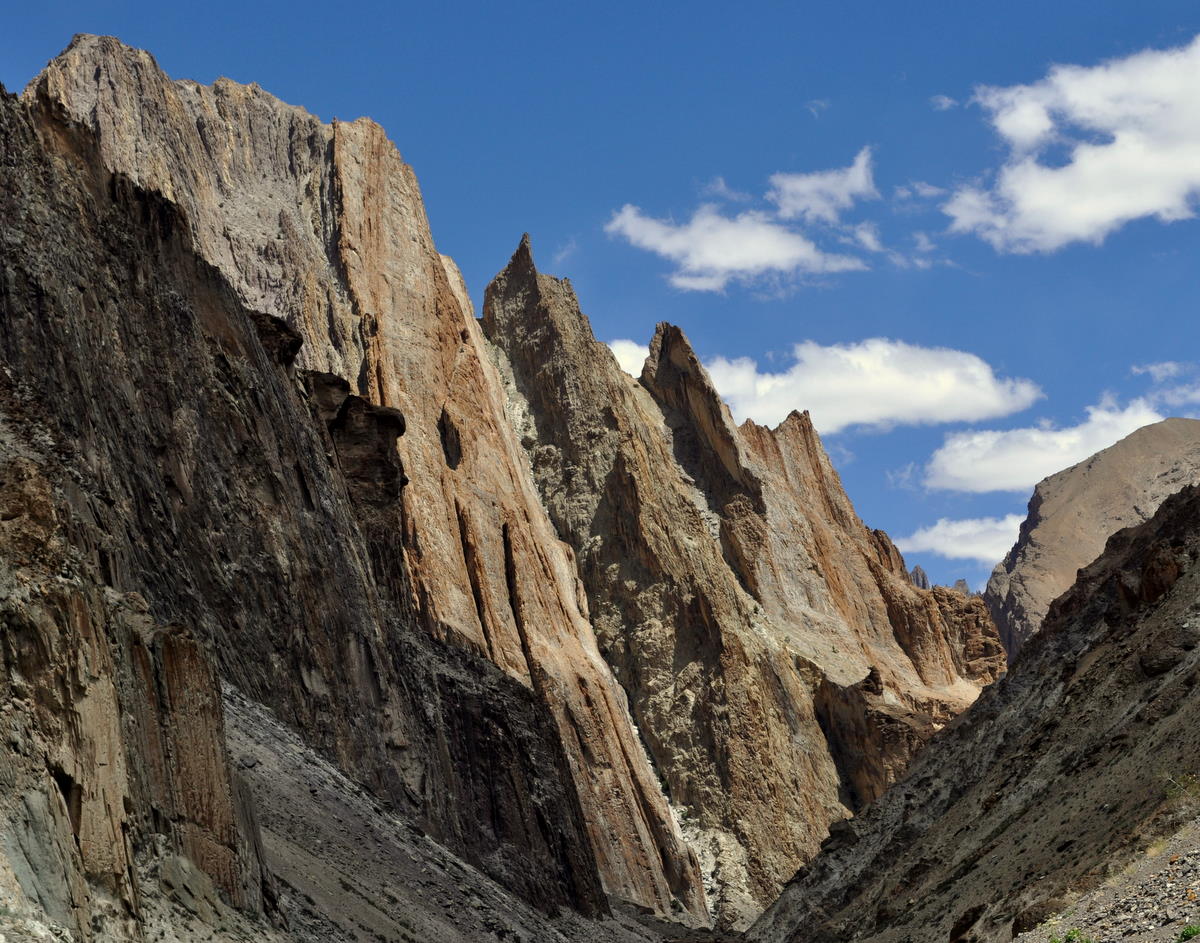
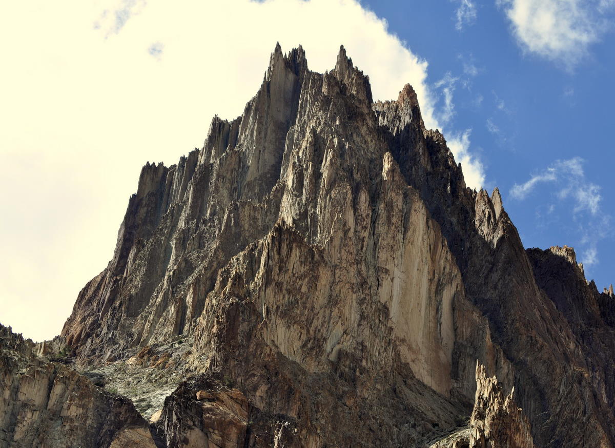
The canyon was one of the most beautiful I have ever been in. Crossing the geological zone between the Indian and Asian tectonic plates, it went through jumbled, colorful rocks that had once lain at the bottom of the Tethys Sea. The mountains above had fantastic knife-edge spires. I remarked that if this canyon happened to be in the United States, it would be the most famous of our national parks, not even the Grand Canyon able to match its splendor and variety. Yet here it was a minor trail used only by local people.


At the road junction a bus from Leh was unloading about twenty workers, teachers and monks who were about to head up the path we had just descended. Among their luggage was a pair of three-meter-high posts for the large prayer wheels at Lingshed monastery on the other side of the pass.

Our truck was waiting having already picked up our luggage from the donkeys at the end of the road. We camped at the town of Wanla, which we had passed through four days before.