Author Archives: Tom

Day 22 – July 3 – Up the valley

This day's task was simply to climb the lower Tsarap valley. The weather was clear and the hiking generally easy, although there were many more ups and downs than were apparent from the minimal elevation gain.

Throughout the day, the rushing river was a constant presence. Swollen by melting snows, the river drains a large part of the southern Zanskar mountains. At Padum in the valley below, its muddy waters become the largest part of the Zanskar river, which further down becomes the largest part of the Indus, some of the only water that reaches the dry plains of Pakistan.


Day 23 – July 4 – Detour to Phugtal Gompa

We followed the lead of most travelers to make a one-day excursion to Phugtal monastery, one of the most important in the southern Zanskar mountains. Several hours up a side valley through rugged red rocks along the rushing Tsarap river, Phugtal is almost two days' walk from the nearest road. The site has been in religious use for at least 2500 years.

The monastery was not visible until we crossed a small ridge at a bend in the river. The sight could have then come out of the Lord of the Rings.


Phugtal monastery was built on the side of a cliff, with its main monastic buildings inside a cave formed by an overhanging rock. The cave walls and roof formed walls and ceilings of several monastic buildings, including the dark gongkang chapel of the fierce protectors. Workers were busy rebuilding and expanding the assembly hall. Other chapels were reached by paths through tunnels formed by monastic residences built out over the canyon, which threatened to swallow any building without a sufficient foundation. From bottom to top, a stairway climbed ten stories through narrow, dark holes in the structure.


After several hours in awe, we returned to our camp at the main valley.

Day 24 – July 5 – Wedding celebration in Testa

On the previous day, we had learned that everyone in the area had gone to the next village for a wedding celebration of a woman who would be moving down the valley to live with her new husband. The tradition is that people from the groom's village come, celebrate all night with the bride's villagers, and then lead the bride and her family on horses to the actual ceremony at her new home. It is common, in fact, for the two to have already been living together for several years after a quiet ceremony to make sure everything was okay before having the big celebration.


By the time we arrived around 11am, everyone had been drinking chang, the local rice liquor, for most of the night. Each villager presented a kata (ceremonial scarf) to the bride, who was sobbing under the weight of saying goodbye to the people she had grown up with. Dancers from the groom's village moved slowly to the beats of drums. Everyone was in traditional dress.

After about two hours, the bride collected herself enough to say farewell to her friends and began walking to the other side of the village, where the horses were waiting. Her family served a final meal of gruel mixed from a dozen pots brought by different families, then she and her closest family mounted their horses and rode off.


For the rest of the day on the trail, we were passed by many people returning to their villages in the surrounding area.

Day 25 – July 6 – A short rainy day

The dark clouds that had been gathering to the south on the day before brought us rain starting at midnight. We knew this was a possibility as we approached the Great Himalayas, since those were the final defense against the monsoon, which could be in full force in most of India by early July.

Fortunately, we had planned this as a very short day and we made it even shorter by going the most direct route to our next campsite. Although we missed a few nice villages and had to use our horses as a ferry across a raging stream, this got us to camp in Karghiak by late morning. We stayed dry in the tent and read books all afternoon.

Day 26 – July 7 – A long rainy day

On the next day, we could not avoid a full day of walking, because we had to get to the top of the valley to the base of the pass. Our schedule was tight at this point to get over the mountains to Manali, where we would catch our flights home. We could conceivably lose a day, but it would have meant long walking and driving. Two days delay and we would definitely miss our flights back to the US.

The weather looked promising when we first got up. At the head of the valley we could see the face of Gumbaranjon, a huge granite dike that had been left where two glaciers met in the last Ice Age. I wish I'd taken my picture then, because the clouds closed in and it began raining again by the time we'd finished breakfast. This was the best picture I could get for the rest of the day.

Walking in the rain is not so bad if you are well dressed and don't let it bother you. I was doing fine for the morning although Marcia was tired. We stopped for tea and eventually lunch in the yak-hair tents of the last herders in the valley. This camp had the nursing mother yaks and their babies, all of which stood outside with the rain draining off their long hair. Yaks are used to this kind of stuff, but they still don't like it.


While we ate, the rain got worse and was quite unpleasant for the afternoon's walk. We just put our heads down and made it to camp around 3pm.


Wouldn't you know, it cleared shortly after we arrived. At least we could enjoy the alpine valley of Lakang, the last flat land before the climb to the pass.

Day 27 – July 8 – Snow on the Shingo La

Today was the big day when we needed to cross the 5100-meter (17,000 foot) Shingo La pass over the Great Himalayas so we could get out and catch our flights in Manali. Our motto was “Manali or bust!”

We awoke at 3am to do the climb while the snow was still hard. Our horsemen had been over the week before, so we knew it was possible, but in this season there was still a lot of permanent snow. And we had no idea how much new snow might have fallen in the storm of the previous days. This pass can be closed for a day or two by monsoon storms even in the middle of August.

The weather when we awoke was not as clear as it had been the night before. A layer of low clouds had formed, and we feared it might rain and snow again by the afternoon. But as we climbed, the clouds burned off and it became perfectly clear.


We did have to deal with about 30 centimeters (1 foot) of fresh snow, however. Our team, including the ten strong horses, broke trail for what turned out to be about 8 kilometers (5 miles) of hiking through the snow. The steps were wide, especially for Marcia, but we were able to follow them without much trouble. I broke through the old snow up to my hips a few times, but that was more comical than dangerous. We were the only group to cross all day. Our trail will certainly be helpful to less well-equipped parties on the other side, some of whom had been waiting three days to cross the pass.


The Shingo La is impressive in any season, as the trail crosses the tips of several mountain glaciers. In the fresh snow, it was remarkable. Off the mountains above fell countless small avalanches and rockfalls, but these were far away and the trail avoided any dangers.


In the bright sun on the other side, I did become concerned about snow blindness. My sunglasses are okay, but I did not have the proper goggles for walking six hours on bright snow. I avoided any problems by taking care of myself and getting down as quickly as possible. Marcia and I did get mild cases of skiers' sunburn on the bottom of our noses, however.


Our other problem was finding our camp. Our destination Rumjak was already a very long day, especially with the extra effort slogging through the snow over the pass. But then, in a replay of Dolpo's “yak man problem,” our horsemen took it on themselves to pass three perfectly good campsites in order to get better grass for their horses. And with them going way beyond our agreed stopping place, even our guide was worried about finding them before dark. Without our camp, we would have been bivouacking without food or sleeping bags at 4000 meters (13,000 feet).

We sent our guide ahead and kept walking slowly for two more hours down the valley. About 5:30 we spotted one of our kitchen staff coming uphill with a pot of juice. Camp was 15 minutes away in a small grassy spot across from a hill where our horses were happily grazing. The horsemen claimed that locals called this place Rumjak. We and our guide were not amused.

We had been on the trail almost 13 hours and were quite exhausted. But we had made it over the Himalayas.

Day 28 – July 9 – Trailhead

The rest of the trail was an easy downhill to a trailhead in the state of Himachel Pradesh.


A few hours’ walk brought us to a large valley. BRO had extended the dirt road from the trailhead to here, although with some bridges missing it was not yet open to vehicle traffic. The road, however, made a very easy trail down to the place where our vehicles were waiting.

We got in a taxi that would take us to the main road and then south towards Manali. We said goodbye to our team, most of whom were heading in a truck north back to Leh.


We stayed in a small hotel on the main road. These were the first hot showers we had seen in weeks.

Day 29 – July 10 – Manali or Bust!

We thought we had it made. From our hotel, it was an easy four or five hours to Manali, a mountain resort where we would spend our last night before flying back to Delhi. We had walked through snow across the Himalayas, what could stop us now?

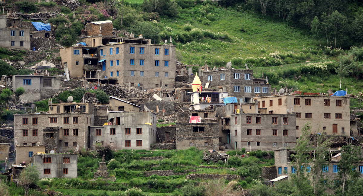
The villages along the way were quite different from what we had seen in Ladakh. Himachel Pradesh is better connected to the main part of India, and buildings are constructed using modern techniques.


The road goes down a long valley and then over a small pass 30 kilometers (20 miles)north of Manali. The pass was under 4000 meters (13,000 feet) and not snow covered. There were a few muddy spots on the climb up the switchbacks, but our driver knew how to keep his car moving and made it to the top.


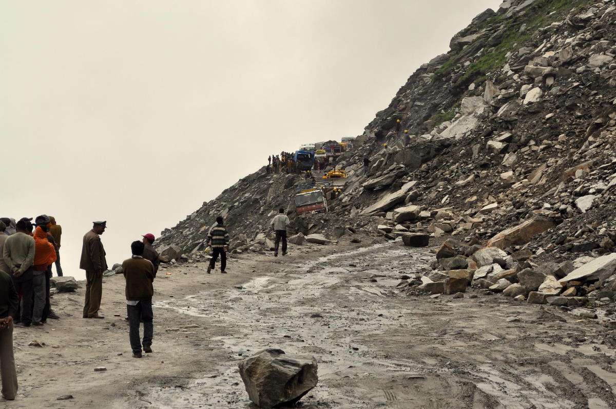
And then we stopped. At least 200 cars and trucks were waiting at the edge of a huge landslide that had come down in the night. No one was getting through.


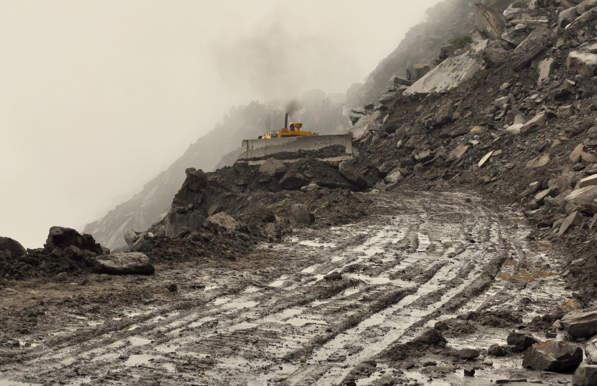
The Indian army and road crew were hard at work and everyone was confident they would reopen the road shortly. They blasted several large boulders and used a giant bulldozer to plow a roadway through the mud. It wasn’t pretty, but several dozen cars finally got through in the uphill direction, which was getting priority over us.


But the hill kept sliding. Some of the slides were minor, and a few hits by the bulldozer cleared them up. One jeep got stuck in the mud, and the bulldozer finally pushed it through, with only minor damage to its rear bumper. But then another huge boulder fell onto the road right where the car had been stuck two minutes before. Back to the dynamite.

By this time we had been waiting for seven hours and daylight was running out. With a flight the following morning and connecting flights immediately after, retreat was not an option. And the next airport was in Leh, two days drive to the north.

So we called a war council. There was a trail of sorts that led down to the next switchback, which was safely below the slide. We could wait in hopes that the road would open, but that would mean hiking down in the dark if it did not.

We decided to walk. Our driver used his cell phone to call his boss in Manali and arrange another taxi to meet us at the lower switchback from the town an hour and a half away. (Our first driver would end up spending the night on the mountain.) We repacked our backpacks so that we could carry everything, with our guide leaving his own bag in the car so that he could help Marcia. In about forty minutes we were down just as twilight was fading.

We did not have to wait long until our new taxi arrived. We piled in and rode down into town. We had made it to Manali!

Day 30 – July 11 – Delhi and home

From Manali, it is an hour’s drive to the Kullu Valley airport, which has daily flights to Delhi as long as monsoon rains didn’t cause a cancellation. Our onward flight to San Francisco left just after midnight, so we had to get out that day. So we had bought both an airplane ticket and a backup ticket on the evening train from close to Chandigarh ten hours away. So if our flight got cancelled, we would have just enough time to drive down and take the train and rush back to the Delhi airport.

Fortunately, the weather was okay and Indian Airlines was flying with only an hour’s delay. We bid farewell to our guide and before we knew it we were back in the heat and noise of Delhi.

Not wanting to be outside in the hot afternoon, we decided to spend a few hours in India’s National Museum, which has a rightly famous collection of artifacts from the nation’s rich history. Unfortunately, the museum’s building is almost as ancient as its collection, and a few fans were the only attempt at cooling. As a result, we could only enjoy a few highlights before returning to our hotel.

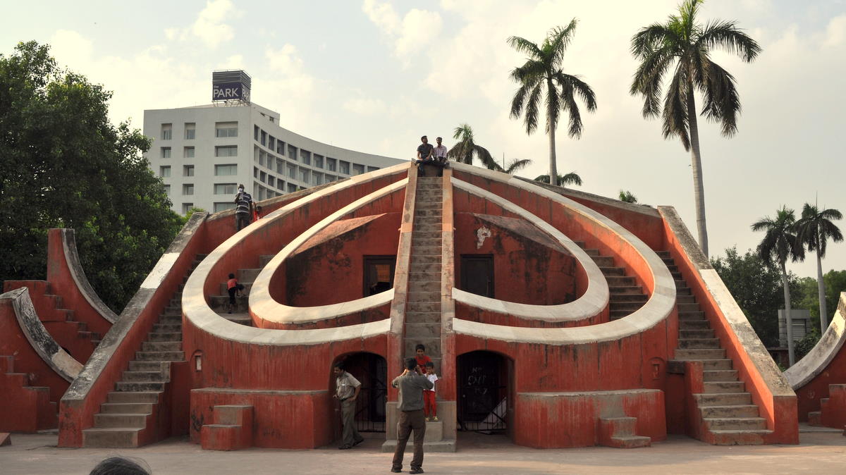
On the way back, I stopped in on another of Jai Singh II’s eighteenth-century observatories. Similar to but smaller than the one we had seen in Jaipur, the Delhi observatory consisted of several large sundails and other instruments that allowed calculation of the Sun’s and stars’ positions in various spots on the globe. It was a fitting end to a very long trip.

————– end of detailed Ladakh trek entries ————–

Ladakh

We flew on the morning of June 1 to Leh, the main city of Ladakh, an enclave of Tibetan Buddhist culture separated by high mountains from the rest of India. Governed as part of the disputed state of Jammu and Kashmir, Ladakh is safe and largely autonomous except for the large Indian military presence.


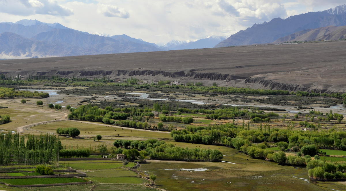
Leh stands at 3700 meters altitude in the Indus river valley, which cuts a wide swath across the mountains on its way from Tibet's Mount Kailas to the plains of Pakistan. On either side are mountain ranges with peaks around 6000 meters, not as high as the Karakoram to the north but still a wonderful frame to this high desert valley. The only roads into the valley cross several high Himalayan passes and are closed eight months off the year.


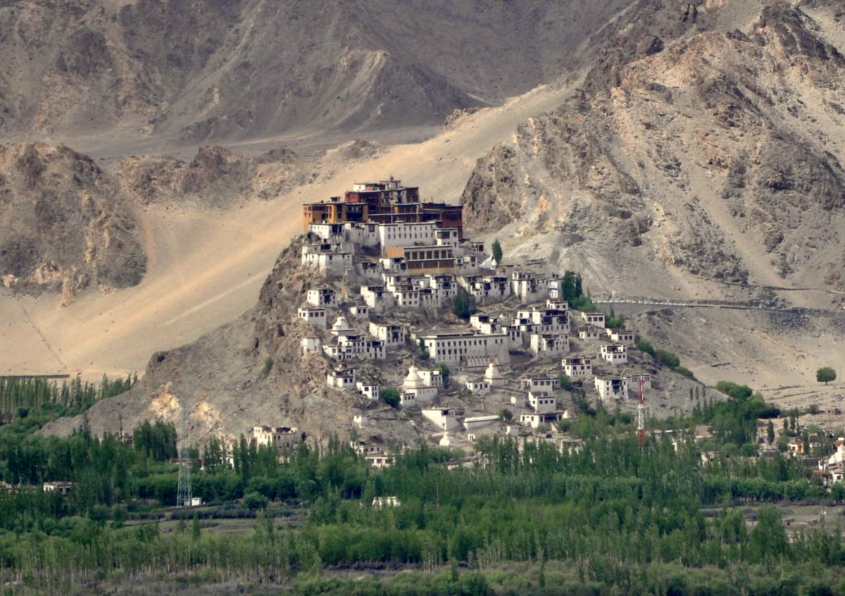
Ladakh has a very active Tibetan Buddhist culture, in a sense the only undisturbed one in the world. Monasteries are everywhere, often built on hills. The Drukpa Kargyu lineage of the Kagyu school is dominant in Ladadk. The Dalai Lama visits at least once a year from nearby Dharmasala.

Leh is a travelers' hangout, though less so than similar towns in Nepal. The main bazaar still serves the locals and the former king's palace overlooks the scene.


We spent our first four days acclimatizing, catching up on email, and interviewing trekking agencies. We prefer not to put our money and safety into people's hands until we can look them in the eye. We found several operators we liked and all seemed able to organize our treks at a very cheap price. But ultimately we decided to go with the most established and expensive operator, because we liked the guide and knew he would come through on our itinerary, which left no margin for error catching our flights home. More on that later.

With that settled, we took three two-day road trips, which I will describe in separate postings immediately below this one.

The last night before our trek, I had intended to do some important work on the internet, including finishing our Nepal blog postings. Unfortunately, this happened to be one of the many days when Leh's internet service was not working. Served by only two government-run ISPs, Leh's connection to the Flat World is cut almost as frequently as its electricity, which is off roughly 12 hours per day. Telephones are also difficult, with cell phone roaming blocked for security reasons throughout Jammu and Kashmir following the Mumbai bombings. After a lot of trying, I was able to get pay-phone calls through to my parents and my brother, who has kindly again handled our most important business.