Monthly Archives: September 2010

Day 15 – Sept 14 – An unexpected dayhike up the glacier

In the morning, our guide came to the tent to discuss our plan. It was still cloudy, but he seemed surprised when I said we had agreed to go down today. But happy to get out, he didn't object.

As the team was finishing packing around 9am, we realized what a mistake we had made. The weather was clearing and it was going to be a spectacular day. Our guide offered that we could take a ona-hour hike before leaving, but that would have made it a really long day. Marcia wasn't interested and she didn't want to wait while I did it. Almost in tears, I realized a one-hour hike wouldn't make things any better, since the big mountains were further away than that.

As a last resort, I made a face-saving proposal. Instead of going downhill today, maybe we could move the camp one or two hours up the valley and then do a more substantial dayhike in the afternoon. To my delight, the team (and Marcia) agreed.

We reached our new camp in about 90 minutes, but already Marcia's poorly waterproofed boots had made her feet wet and cold. It was probably good we hadn't gone eight hours downhill in the snow like that. With the bright sun, more snow should have melted by tomorrow, and the long trip downhill should be easier. Not as interested in the high peaks as me, Marcia elected to skip the dayhike and spend the afternoon in the tent.

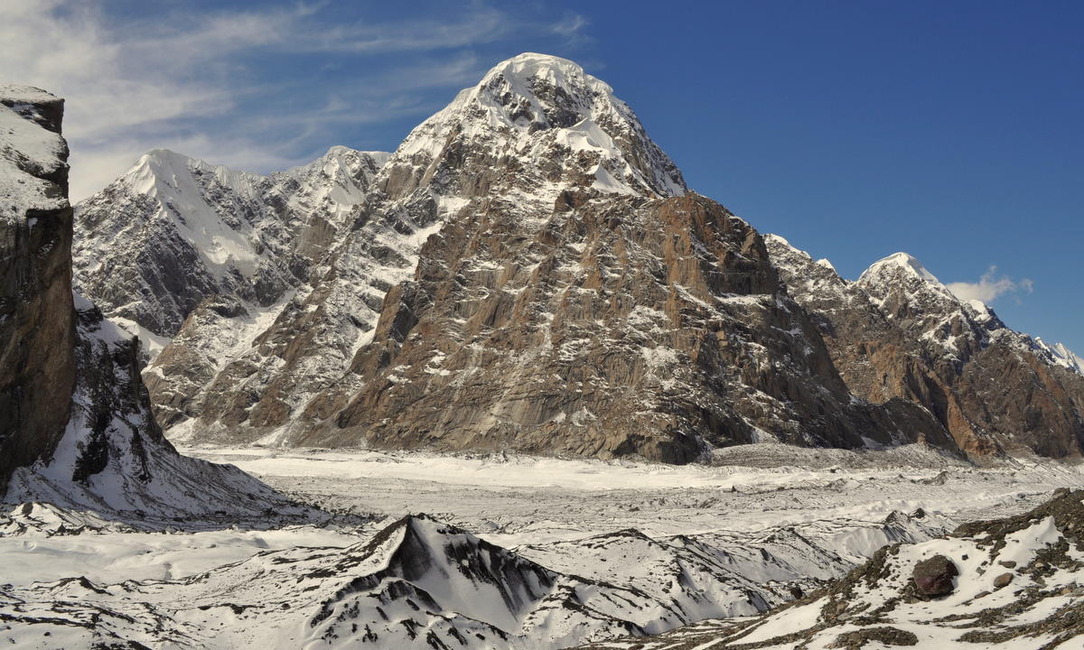
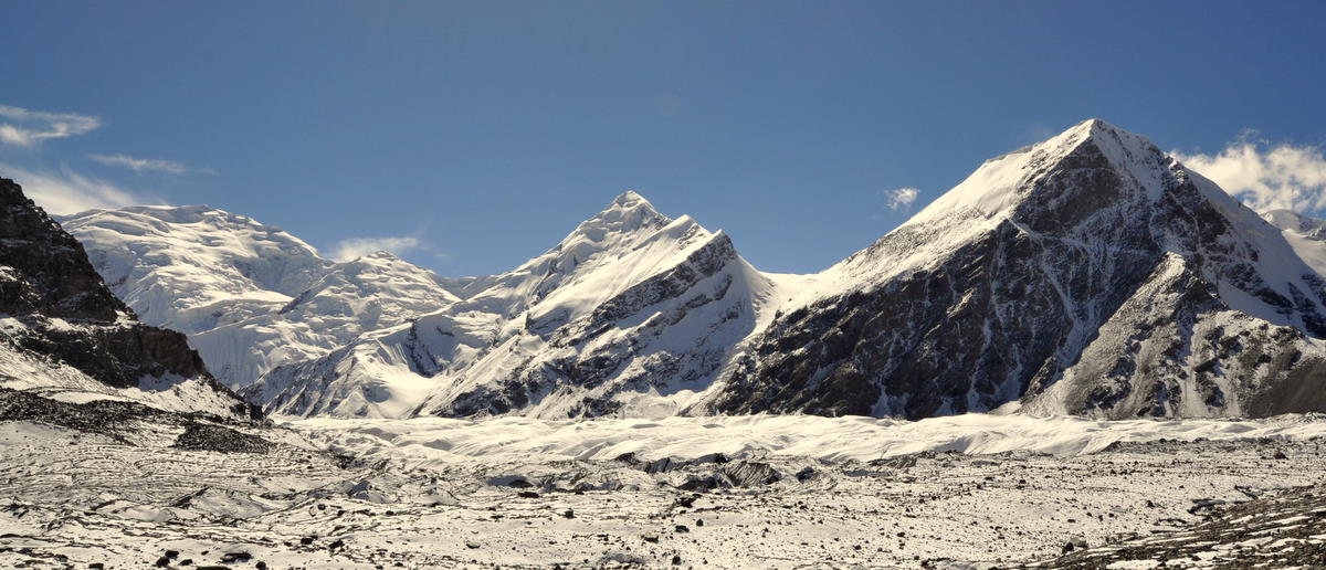
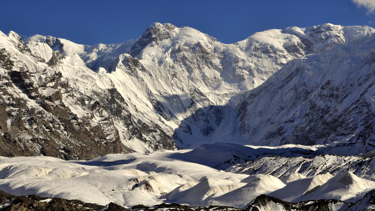
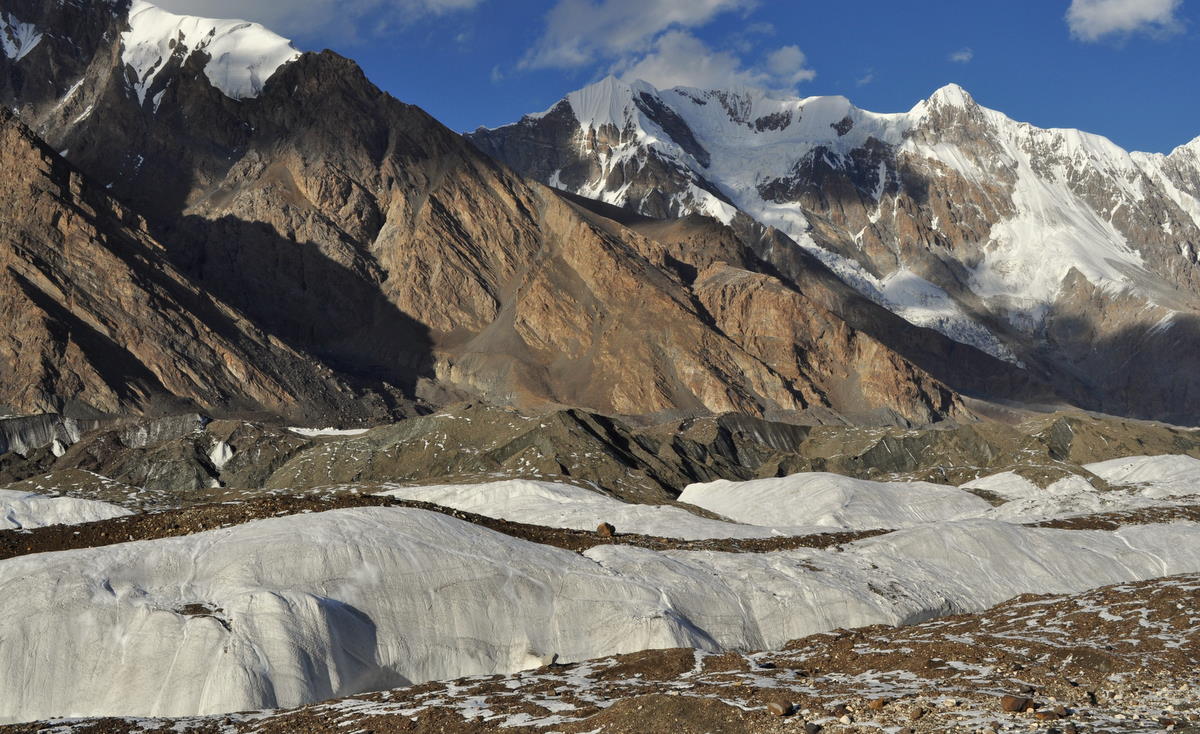
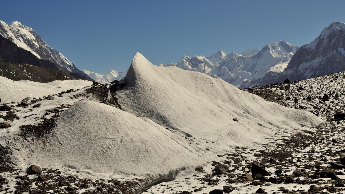
Ah, what scenery! We went about two hours further up the valley, though not quite to the base camp. Glaciers sparkled and the high peaks were spectacularly clear. We were able to get a good view of the avalanche-stroked south face of 7000-meter (23,000 foot) Khan Tengri. The views were still oblique and not the classic Matterhorn-like perspective, but it was the best we could do under the circumstances. The elusive 7450-meter (24,400 foot) Peak Pobiedy remained hidden behind other peaks, but at least we had seen it from the passes the week before. I returned to camp tired but satisfied.


Day 16 – Sept 15 – Down the glacier

This was a long and difficult day that began our trip back down the glacier. Because of limited campsites, we had to make it all the way back to Merzbacher Meadow, reversing the route of Day 13 plus the 90 minutes we had walked further yesterday. At least it was mostly downhill.


The first part of the day went quickly, as our guide was able to find a way across a shortcut that had not been possible on the way up in the snow. This saved us at least an hour since we no longer needed to walk all the way around a large glacial lake.


Further down, however, we found that due to higher meltwater, we could no longer cross a glacier-top stream and an icebridge that had simplified the passage across a difficult side glacier. So we had to take another route across difficult glacial ridges and a long stretch of boulders on top of the glacier. Finally we made it to the moraine and up to Merzbacher Meadow, where we had camped two nights earlier in the trip. It had taken us nine hours.

Although the snow had mostly melted, falls were almost inevitable on the loose rock and slippery glacial ice. Both Marcia and I slipped several times, and I once cut the palm of my left hand, fortunately not badly. I managed to avoid reinjuring my ankle, which was still hurting and weak from the fall I had taken in Canada.

Unfortunately, there was a new sprained ankle in our team. The young woman interpreter Jennia, athletic though inexperienced at hiking, had gone with the porters so that she could hike fast. Being fast and strong, the porters leaped across the stream and icebridge that our guide had wisely turned us back from. Trying to keep up, Jennia also tried to leap but came down on the side of her foot, spraining her ankle quite badly. The porters had to mostly carry her to camp, arriving only a few minutes before us.

Day 17 – Sept 16 – An easy day down the moraine

This day reversed the path of Day 11, the four-hour day up the second part of the moraine. It was mostly level or an easy descent, so we made it even faster going down.


Our hearts all went out to our interpreter Jennia, who bravely limped much of the way on her sprained ankle. I suggested to our guide that we could create a sling for her using the climbing rope, but the other porters seemed to do fine just carrying her across the difficult sections.

The weather had been sunny but deteriorating for the last day or two. Around 5pm, the clouds moved in quickly, and it began snowing after dinner. Fortunately, the wet snow melted on the ground, so our difficult trail for the next day would be muddy but not icy.

Day 18 – Sept 17 – Down to the toe of the glacier

We knew this would be a difficult day, since it reversed the route down the moraine that we had disliked on Day 10.

To make matters worse, it began snowing again as we packed our camp and continued to snow all day. Although it melted for the most part and didn't make the trail particularly slippery, it was unpleasant and cold, especially for Marcia.

Perhaps because of the snow, we kept moving and made it down in under five hours, much less than we had spent going up.

Also, our guide listened to my complaints about the rockfall dangers of the most difficult stretch and chose a different safer route that took us down across the toe of the glacier. This was good, because the rain and snow had loosened the slope so badly that it would have been a constant rain of rocks falling from high above. We called it the “bowling alley” and admired it from a distance.

Just before we arrived in our camp, we saw an impressive slide on the opposite slope. Along with a lot of rocks and dirt, a full-size fir tree came tumbling down the slope and cracked in two. Nature is powerful.

We spent the afternoon in our tent trying to stay as dry as possible in the continuing rain and wet snow.

Day 19 – Sept 18 – Trailhead

It continued to rain most of the night and our raingear and other things were still very wet when we woke up. I am a Stoic and take such things in stride, especially on our last day when we could carry out a few wet clothes. But Marcia was not pleased. Fortunately, the rain pretty much stopped around the time we had to begin walking.


Our last day of hiking was a mostly level walk down the Inylchek valley left behind when the glacier receded. At one stretch, however, we had to climb high up a steep bank to avoid the river. This stretch was very slippery due to the rain, but we somehow made it through.

Soon after that at the planned trailhead called At-Jailoo, we rejoiced to see our vehicle coming up the valley to meet us. This was the same six-wheel-drive ex-Soviet military transport that had taken us out on Day 1, and now its serious power was clearly needed, as there was no road for the next 30 kilometers.

With fresh food, we had an excellent lunch. The jeep also brought a bottle of vodka, which we quickly drained in toasts to our successful trip.


The plan had been to camp there and drive back the next day. But since some of the porters were also cold with wet sleeping bags, everyone agreed we should try to drive back rather than spending another night in the tent. The drive was seven hours, but we'd be glad to have a shower and a bed, no matter how late.

But nature soon blocked us. The jeep track climbed a slope above the river, often very steeply. In one place, even the six-wheel drive was insufficient and our team had to get out and put branches over the mud.

And then we reached a mudslide that had happened in the few hours since the jeep passed the other direction. A large tree was blocking the road and even the jeep's 6-ton winch couldn't move it. After several attempts, we backed down the road to a place where we could turn around and went back almost to the trailhead, where we could abandon the track and just drive right down the river bed. By this time we had lost three hours and it was getting dark.

Rather than drive all night through challenging terrain, we all agreed to stop and spend the night in and alongside the vehicle. We'll try again in the morning.

Day 20 – Sept 19 – Out at last

The next morning we started driving at the first light.

At first we made slow progress because driving down a river bed is not easy, even in a soviet personnel carrier. And the vehicle had a few engine problems that required tinkering. Like my old Volkswagen, a soviet tank only sort of runs, but it does that very consistently.

After an hour or so, however, we managed to get back on the track on the side of the hill, and we made faster progress.

At the base of the valley, we passed the modern ghost town of Inylchek, an old tin mine with a huge set of soviet-era buildings. Only a few people now live there, and the road is abandoned except for hiking trips.

There was about 10 centimeters (4 inches) of snow at the pass we needed to cross, but that was no problem for a soviet personnel carrier.

We were happy to get back to Karakol and a good shower.

—– end of detailed Kyrgyzstan postings ——

Back in Karakol after a wonderful trek

We returned in good health today from our 20-day trek in the Central Tian Shan. It was a wonderful wilderness experience, quite different from trekking in India or Nepal.

But the mountains were just as amazing. The Tian Shan reaches its highest point in this area of eastern Kyrgyzstan, with several mountains over 7000 meters and some of the largest temperate mountain glaciers in the world. We walked and camped on one of these for several days, and it was quite unique.

Our only complaint was the weather, with four rainy and snowy days and several other stormy evenings. The snow did prevent us from getting all the way up the glacier, where we would have gotten the best views of the highest mountains, but we still got close enough to have our rather soggy socks knocked off.

As with our other treks, we made day-by-day notes and pictures for those who want details, but it may be some time before I can assemble and post everything.

Our next step, if all goes well, is to cross the Torugart Pass and spend a week in and around Kashgar, China, then cross another pass through far southern Kyrgyzstan and then across the Pamir Highway in Tajikistan. All of these are legendary, isolated routes, but weather and political problems could always force us to change our plans. Stay tuned to watch our progress!