Category Archives: 1 – Kyrgyzstan

Kyrgyzstan trek day-by-day

What follows are a series of day-by-day postings with descriptions and pictures of our trek in the Tian Shan (Heavenly Mountains) of Kyrgyzstan.

This was a trek like none other. This region of Kyrgyzstan is essentially uninhabited except for a few nomadic horsemen, so the area is mostly trailless wilderness. We saw no one outside our party for the last two thirds of the trip.

And yet the scenery was unsurpassed. The Tian Shan mountain range extends from Mongolia to Central Asia. In eastern Kyrgyzstan, it reaches its highest point with several peaks above 7000 meters (23,000 feet). Down from these mountains extends the 64-kilometer (40-mile) Inylchek Glacier, the third longest temperate mountain glacier in the world. This unique mountain area ranks with the Himalaya and Karakorum as one of the best in the world.

Most climbers go directly to the glacier on soviet-era helicopters that fly in July and August. Because we could not come until September, we arranged to take the long walk in across verdant hills and lower mountain passes. This gave us time to enjoy the broader Kyrgyz landscape and to get some superb mountain views. Less than 400 people take this route each year.

As before, I have organized the postings so they should follow in order. You will need to use the navigation pane or press the “Older postings” link at the bottom of each page to go through the complete list.

Day 1 – August 31 – Transport to the trailhead

We got a late start because of several technical problems I was having with my new satellite phone. In theory it was supposed to send and receive email, but the interface is so old-fashioned it was hard to figure it out. At one point, I made a change that prevented everything from working. I finally gave up and told people just to send text messages for now.

We had time, fortunately, because it was only a three-hour drive, even allowing for stops to throw water on the overheating engine of the Soviet-era military transport. In fact, we didn't need such a heavy vehicle for the trip out, since most of the road was paved and the dirt part at the end was well graded. We'll need it for the return trip, though.


The terrain was alpine, with wide glacial valleys and streams. The transition from desert to trees to alpine treeline was almost immediate.


The weather pattern seems somewhat regular. In the morning it tends to be clear and calm. As it warms up, the wind blows up the valleys from the lower elevations and clouds might build. By the mid-afternoon, the clouds might turn into thunderstorms, after which it becomes clear and cold. At night the wind reverses and blows back down the valleys. Daytime temperatures are warm (25 C = 77 F) and nights are near freezing. On the glacier later in the trip it could get down to -15 C = +5 F. Fortunately we brought our winter sleeping bags.

This is less of a five-star trip than we had in Ladakh or even Nepal. Marcia and I share an ultralight tent barely big enough for us and our stuff. There is no separate dining or toilet tent. The guide doubles as cook and prepares food over a backpacker's butane stove. We have only three porters and the guide to carry everything in huge expedition packs. A young woman interpreter rounds out the team but only carries her own stuff. The team consists of three ethnic Russians, one Kyrgyz, and one Tatar. They speak Russian amongst themselves, as is common in Kyrgyzstan.

Day 2 – Sept 1 – Our first pass

On our original plan, we had added an acclimatization day at the trailhead, because we were concerned about going from sea level straight to a 3200 meter (10,500 foot) camp and a 3700 meter (12,100 foot) pass. Marcia had some problems doing such things in both Nepal and Ladakh, so we wanted to be conservative. But of course, we had done the same thing many times without problems in the Sierras.

We were feeling fine except for minor headaches, so we decided to skip the acclimatization day and go straight over the pass. It was an easy climb and despite some breathlessness, we made it to the pass in two hours.


The terrain in this part of Kyrgyzstan is much less rugged than the Himalayas. The pass was just a rolling summit and the slopes on either side were gradual.

The harder part was actually the descent, because the grasses gave way to weeds that masked numerous animal holes. I took a spectacular spill on one place where my recovering left ankle gave way. Rather than risk a new injury to my foot, I took a hard fall on my body. No harm done, fortunately, but we moved even slower after that.

Hiking in Kyrgyzstan is essentially bushwhacking, with no established trails beyond an occasional faint track. Unlike Nepal or India, the population is low in Central Asia, especially so in the mountains. The few people living here are Kyrgyz horsemen nomads, who do not live in villages. And there are very few visitors. It reminded us of hiking in the Gates of the Arctic park in northern Alaska.


We made it to camp at 2pm just before the first thunderstorm hit. A group of Kyrgyz horsemen came by to show off the marmot they had shot. Our guide warned us to keep everything inside our tent, as thievery is common among poor nomads.

Day 3 – Sept 2 – Ashu-Tor Pass

Our task for today was to cross another 3700-meter (12,100 foot) pass into a different lateral valley still on the north side of the hills. It was an easy climb mostly up an abandoned jeep trail, though it seemed longer because we must have camped a little lower.


The weather was a problem. It was already cloudy when we awoke, and by noon a fairly big thunderstorm had already developed. Fortunately this one passed us to the north and allowed us to make it over the pass with only a few drops of rain. But once we sat down for some lunch on the other side of the pass, another storm hit and showered us with hail and rain. We covered up as well as we could and ate, but as the rain showed no sign of letting up, we were forced to hike the remaining six kilometers in the rain. Thankfully, the jeep trail continued most of the way and we could walk pretty quickly

Day 4 – Sept 3 – Another day, another pass

The next two days were to be devoted to crossing the mountains into the huge Saryjash valley to the south. To do this, we had to cross something marked Echkilitash Pass on the map. The elevation gain was about the same as the previous day, but the distance was longer. Some gonzo twenty-somethings do this all in one day, but our plan was to take two.

The weather looked bad. Although it was not raining when we awoke, the cloud cover was heavier than any day before. It looked like it could begin raining any moment and continue all day.

We held a council and reviewed our options. We had a spare day and could hole up in our tents if we wanted. But our guide and I both observed that such a weather pattern could continue for days. We could move camp about an hour across the valley, but we would still lose the day if we didn't make it to the pass. So we reluctantly agreed to continue through what promised to be a rainy day.

The team prepared breakfast and started to break camp. Just before our tents had to come down, a heavy cloudburst hit and we took shelter. It only lasted a few minutes, but we were pretty discouraged. Marcia would have abandoned the whole trip if she'd been given the choice.

We spent our first hour crossing to another side valley. This required us to wade two stream crossings in our sandals. On the slopes we were able to stay high and avoid too much elevation loss.

At the end of the second stream crossing, we observed some unexpected sunshine. A fairly large hole had opened to the north and we could even see some breaks in the clouds overhead. At first we dismissed it as a “sucker hole,” but when the clouds continued to break we thought it wise to apply sunscreen.


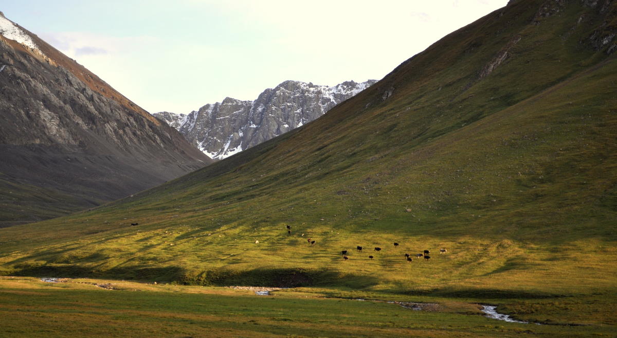
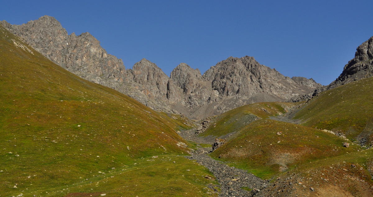
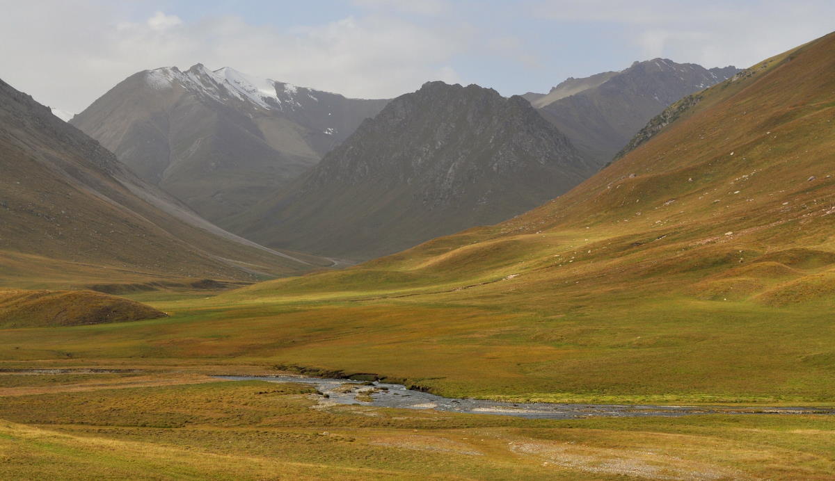
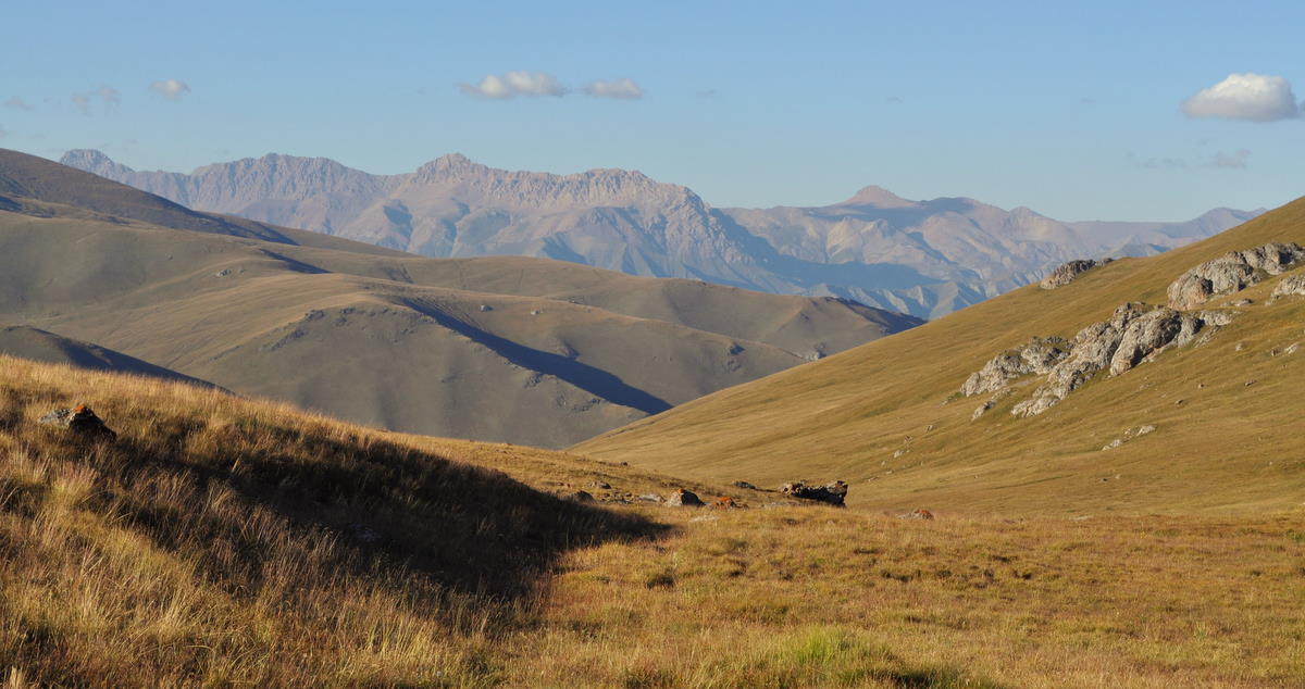
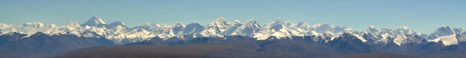
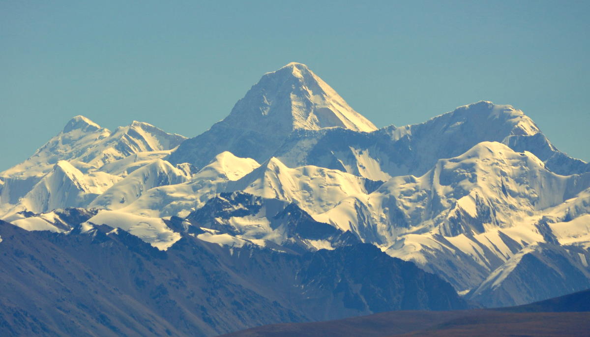
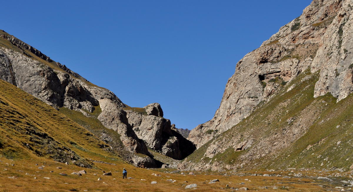
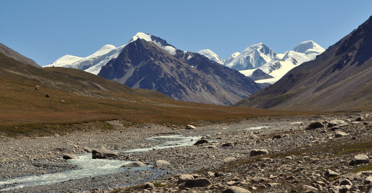
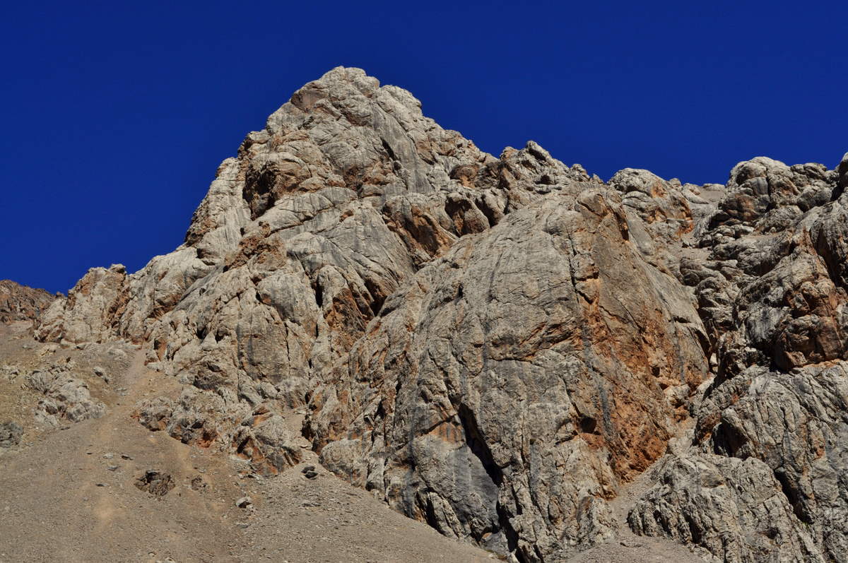
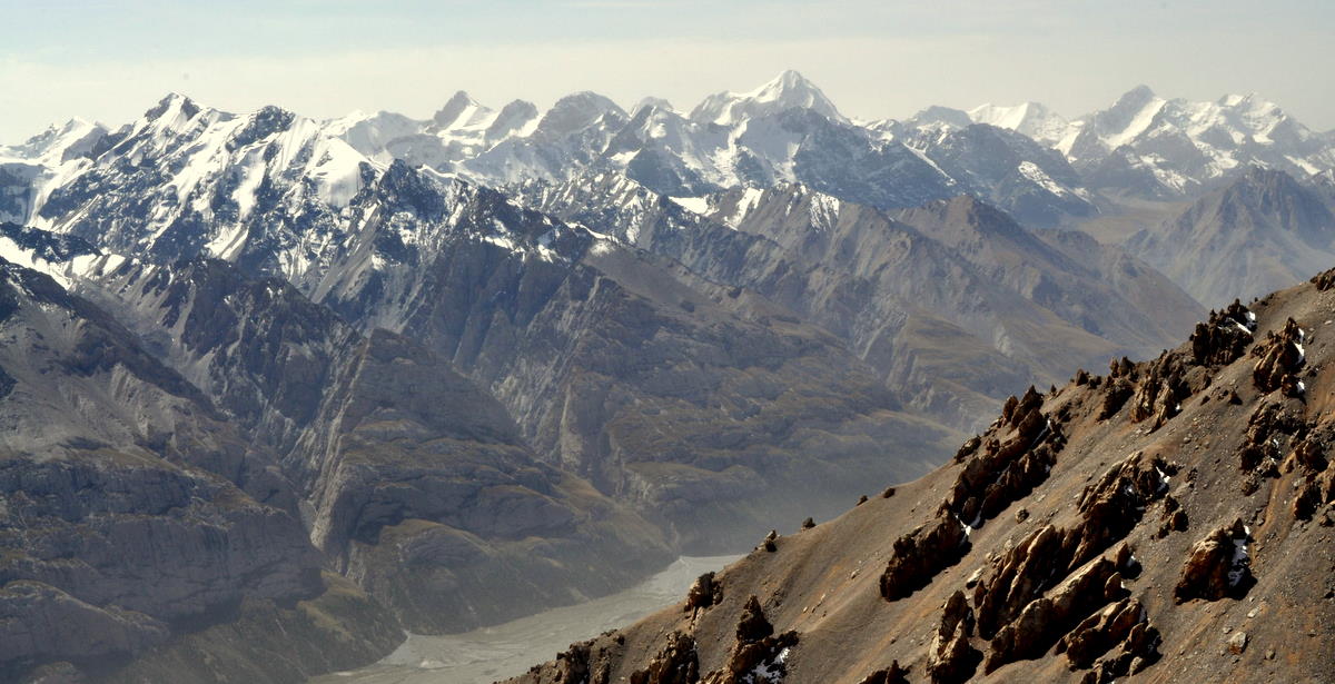
We climbed relentlessly along the side of a hill leading up to the ridge at the end of the valley. It was tough going and seemed longer than either of the two previous days. We finally reached the top right where the lateral hill met the ridge and were rewarded with our first view of the snow mountains of the Tian Shan to our south. The storm had now broken and left the air crystal clear.

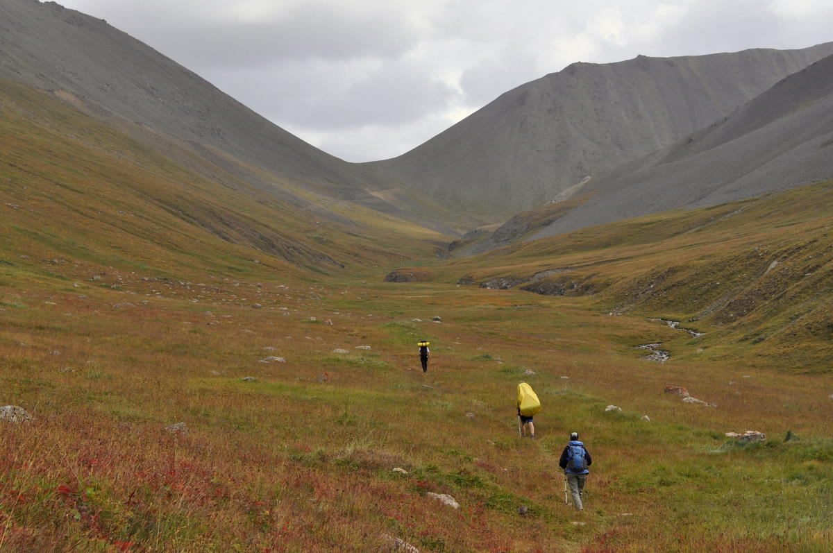
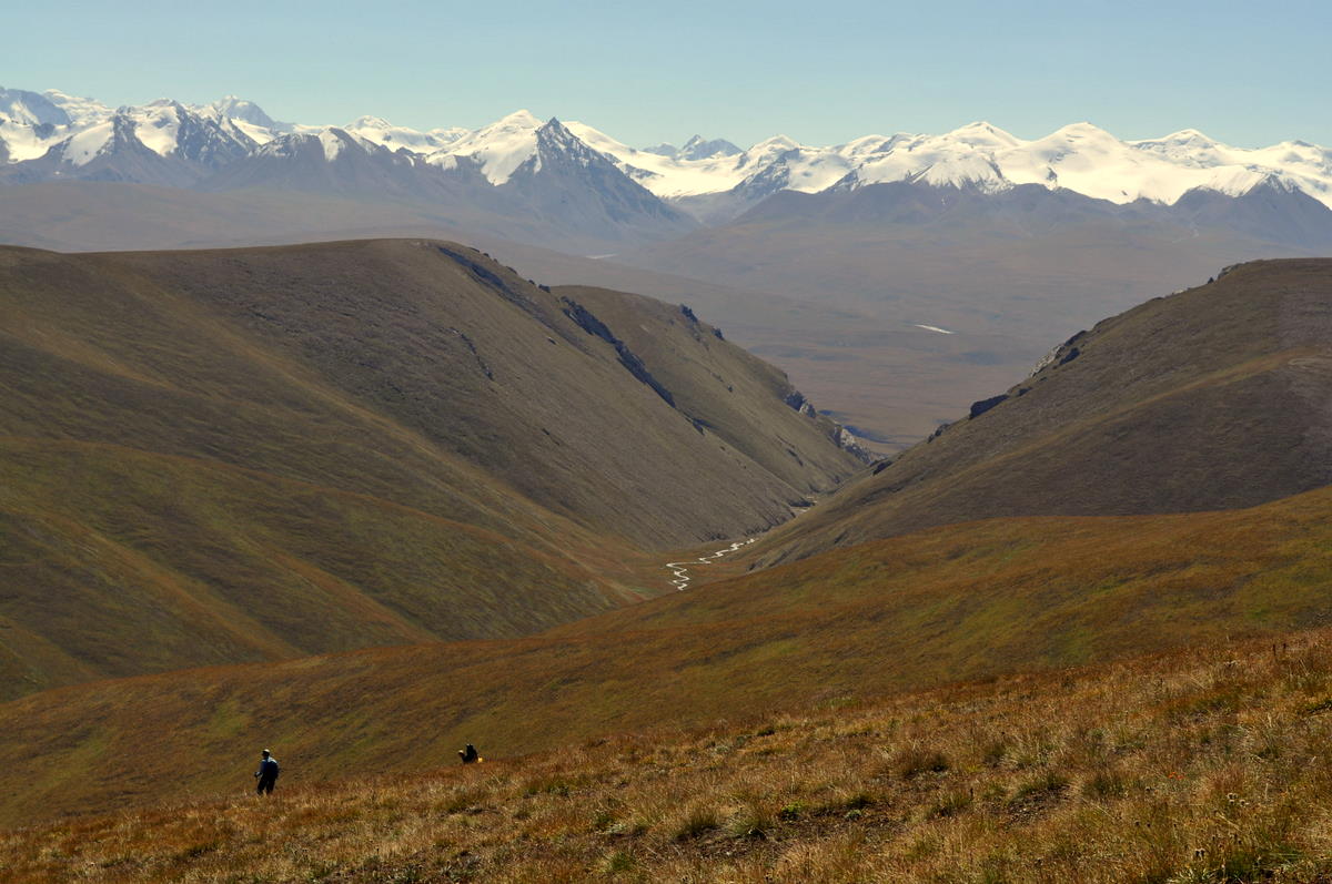
We were shocked to hear our guide congratulate us on crossing “the first pass.” He assured us the second was only 40 minutes away, so we followed him thinking the true pass over the ridge would be just around the corner. Instead, he led us all the way down into the next lateral valley that still flowed north into Lake Issyk-Kol.

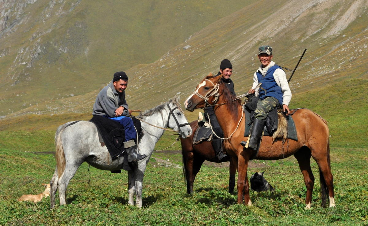
We were happy to see our porters coming back to look for us when we reached the bottom. They had crossed the lateral hill at a lower point and were wondering what was taking us so long. We were a bit annoyed that our guide had taken us over a needlessly high pass, but of course that gave us the chance to see the high mountains.

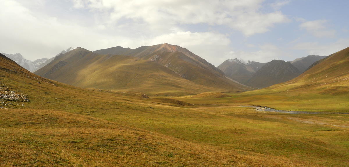
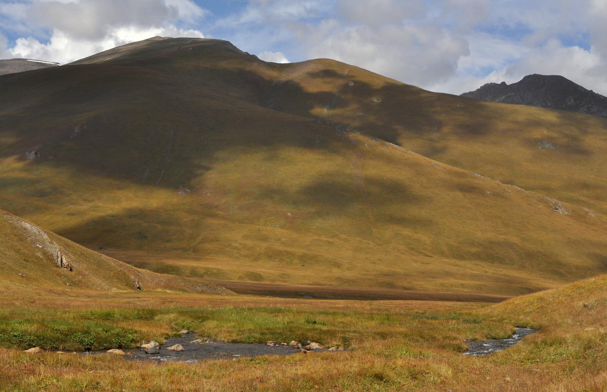
We camped in that valley rather than crossing the second pass. It was now bright sunshine and we could spread our things out to dry. Marcia was glad I hadn't given her the option to quit.

Day 5 – Sept 4 – Crossing to Echkilitash

We woke in good spirits. The weather was perfect and seemed sure to stay that way all day. Our clothes were dry and we had only a short climb to the final pass separating us from the Saryjash valley to the south.

When we reached the pass, we had a wonderful view of the big valley and the Saryjash range beyond. It was an amazing series of snowcapped peaks, all the more amazing when we realized these 4500-meter summits were the low ones! The hills to the left obscured the 7000-meter peaks of the central Tian Shan (Heavenly Mountains in Chinese).

We didn't have long to wait. Rather than descending the valley, our guide led us on the easy rise to the next hill. From there we could see the whole expanse of the Saryjash valley and the Central Tian Shan. In all my travels I have never seen a finer mountain panorama. On the left end was the 7000-meter (23,000 foot) pyramid of Khan Tengri, celebrated as one of the most beautiful mountains in the world. In the distance was 7450-meter (24,400 foot) Peak Pobiedy, the second highest mountain outside the Himalayas and Karakoram. To the right stretched several high ridges. We will cross the first of these at a 4000-meter pass and then spend the last half of our trip on the sixty-kilometer glacier that separates the two ranges.

(Click picture to enlarge)


The descent was long but generally easy. Near the bottom the rolling hills tightened into a narrow canyon that required numerous crossings of a medium-sized stream. Marcia waded in her sandals, but I was able to jump from rock to rock without mishap, despite the weakness of my left ankle, which was still recovering from its sprain two weeks earlier.


Our camp was along the river at a military outpost named Echkilitash. The commanding officer looked through our papers carefully to seem important, but found them all in order.


From our tent, we could look up the long inclined plane leading to the lower snow mountains. It reminded us of the Owens Valley on the east side of the Sierras, except there the inclined plane is on the opposite side of the valley. We watched sunset turn to alpenglow to a deep field of stars. The nearest town was over 100 kilometers away and there were no lights in the valley.

Day 6 – Sept 5 – The Tiüz river valley

Today was a relatively easy hike along the Tiüz river, a side valley up the inclined plane to the south. Tiüz means flat in Kyrgyz, and the valley is indeed flat in its lower reaches, climbing only 200 meters in 12 kilometers. The river is braided in its gravel course.


Looking forward, we could see the snow mountains of the Saryjash range and sometimes the higher mountains of the range beyond. We will cross the Saryjash range two days from now at a narrow 4000-meter pass that is not yet visible in the mountain wall.


Looking back, we could see the hills we had crossed over the first five days, with the snow mountains on the horizon back near Karakol. We saw no one except a pair of Kyrgyz horsemen. They would turn out to be the last humans we would see for the next 13 days.

The weather remained beautiful. In Kyrgyzstan, September often has much nicer weather than August, which may not be saying much since this year's August was especially wet and cold. But in hopes that it will continue, we moved up the date of our resupply point so that we could maximize our time on the glacier.

Day 7 – Sept 6 – Upper Tiüz river

We continued our gradual ascent of the Tiüz river valley all morning. It was cold enough to leave some morning ice on streams.


About an hour into the day, we needed to cross the river, our most serious stream crossing yet. We waded together holding hands so that no one could fall. The glacial water almost reached our knees and was so cold we almost lost feeling by the other side.


In its upper reaches, the Tiüz river makes several right-angle bends. The geology makes the major valleys run east-west, and the river mostly follows them with occasional north-south jumps to the next valley.

Around noon, we left the main stream and followed a tributary up a steeper hill to the south. This is the way to the Tiüz pass, around two more right-angle bends. We camped near a large rock just before the steepest ascent. There was a flock of blue sheep (bharal) across the valley.

Day 8 – Sept 7 – Crossing Tiüz pass

Tiüz pass is more serious than the other passes we crossed earlier. It is 4001 meters (13,100 feet) high and steep on both sides, with some patches of permanent snow. The terrain is a glacier-left desolation of small stones with nothing growing. We could only think of one place in the Sierras that is similarly desolate: the hard-to-reach Ionian Basin.

Since we camped high, the final steep climb took only a couple hours even at our stately pace. The view was remarkable, and I accepted our guide's suggestion to climb a small peak for an even better perspective. From there, we could see the entire Inylchek valley and the 60-kilometer-long glacier where we will spend most of the next 10 days. Peaks Khan-Tengri and Pobiedy towered over the top of the glacier. Straight across the valley was the 3000-meter (10,000 foot) face of 5700-meter Nansen peak.


On the mountains above the valley, a mountain glacier flowed across its valley.


The weather was deteriorating after three glorious days. Although the sky was still cloudless when we reached the top, it was growing hazy with water vapor, especially to the west.

The 1200-meter (4000 foot) descent was difficult, especially for Marcia, who continues to favor the knee she hurt many years ago in a skiing accident. I too went slowly to avoid reinjuring my recently sprained ankle. We both made it down without incident.

We camped at a place called Chon-Tash (“big rock”) not far from the foot of the glacier. It had been a long but wonderful day.

Day 9 – Sept 8 – The toe of the glacier

Today was a short day, because we just needed to cross the valley to meet our resupply team. That team consisted of two porters who left Karakol two days earlier with another ten days of food, fuel and toilet paper.

Crossing the valley was easier said than done, because the large Inylchek river issued straight from the toe of the glacier. Wading such a large river was not an option, so our only choice was to use the glacier as a huge snow bridge.


The Inylchek glacier is 60 kilometers long, the third longest temperate mountain glacier in the world. It is also one of the fastest moving at 5 meters per year. This means that the ice at the toe is 12,000 years old, from about the end of the last ice age. At that time, the glacier would have been much thicker, maybe reaching the striations we could see on the canyon walls 500 meters above.

It also means the glacier had had 12,000 years to collect rocks on its top from rockfalls and glacial grinding action. In fact, the surface was so dirty that it was hard to tell where the downstream rubble field ended and the glacier began. But we knew we were on top when we began climbing 100 meters to surmount a crevassed area above the emerging river.

We had the afternoon off once we reached the resupply point. That was unfortunate because the weather was still reasonable for hiking, but our team needed to sort the new food and the next campsite up the glacier was too far to reach before dark.