Monthly Archives: September 2010

Back to Kyrgyzstan

Now it is time to leave Kashgar and return to the mountains of Central Asia.

At 5:00 Monday morning, our driver will pick us up and take us to the Kyrgyzstan border, where another driver is supposed to be waiting. We will spend one night in the Kyrgyz mountain crossroads of Sary Tash, then cross the Tajik border and proceed along the Pamir Highway to Murghab.

Once there, we will spend a few days exploring the high Pamirs and then drive down the Tajik side of the Wakhan Valley, along but not over the border to Afghanistan. We will then reach the larger town of Khorog and either drive or fly to Dushanbe, the capital of Tajikistan.

All this will take one and a half to two weeks, and blog postings may be few or nonexistent during that time. See you on the other end!

Kashgar

Ah, Kashgar. The great oasis city on the edge of the formidable Taklamakan Desert. The meeting point of the northern and southern silk roads. The remote listening post of Russian and English consulates staring down the road at each other and playing the Great Game for control of Asia a century ago.

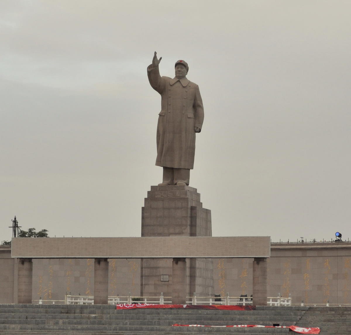
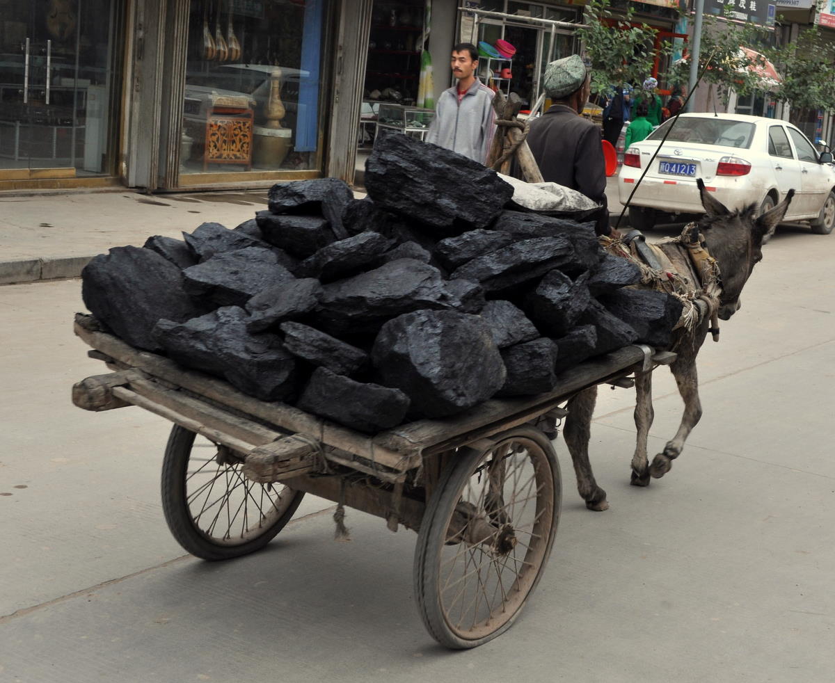
I have my own history with Kashgar. During my first trip to China in 1987, I became one of the first western travelers in 50 years to visit Kashgar and the Karakoram Highway to Pakistan when I found myself unable to enter Tibet, which had been closed by unrest. At the time, China was still a black-and-white movie of worker's coats and grimy streets. When I stepped into the colorful bazaars of Kashgar, it was as if I had landed in Oz. There were no paved streets or cars. Donkey carts padded along beside water channels lining every street. The huge Mao statue stood on the edge of town ignored by the local population.


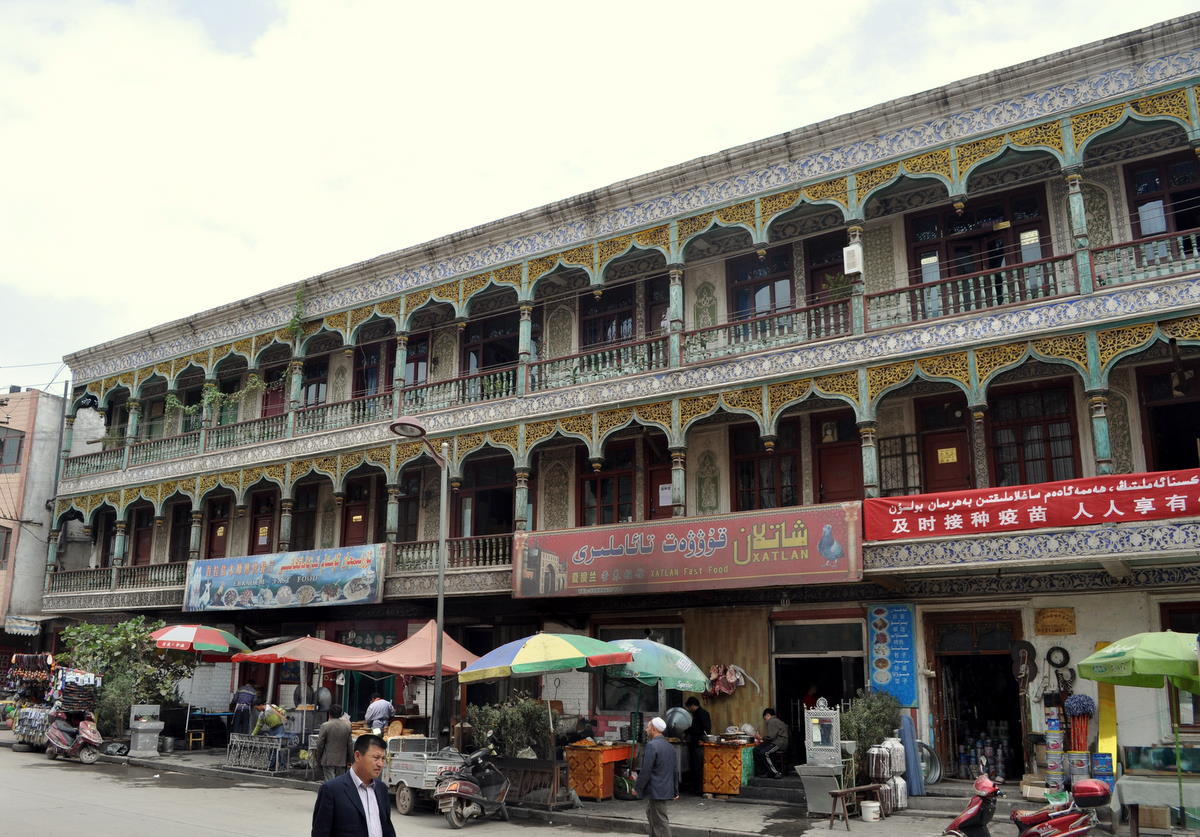
Some cities are bounded by time as well as space. The Kashgar I had known was gone – still there in another time but gone from the present, replaced by a gritty, bustling Chinese city with cars, wide streets and underground shopping malls. The water that used to run alongside the streets now goes into pipes.

In the intervening 23 years, China's “Develop the West” program has paid millions of people to move to Xinjiang, the “new border” in an attempt to overwhelm and subdue the native Uighur population. Billions of dollars have gone into trains, paved streets and urban reconstruction, which in China means knocking down whatever was there and replacing it with drab apartments and an occasional concrete reproduction to entertain tour groups.


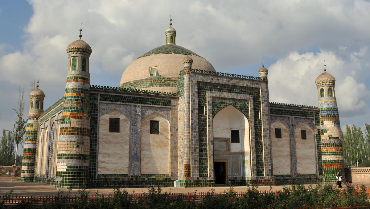
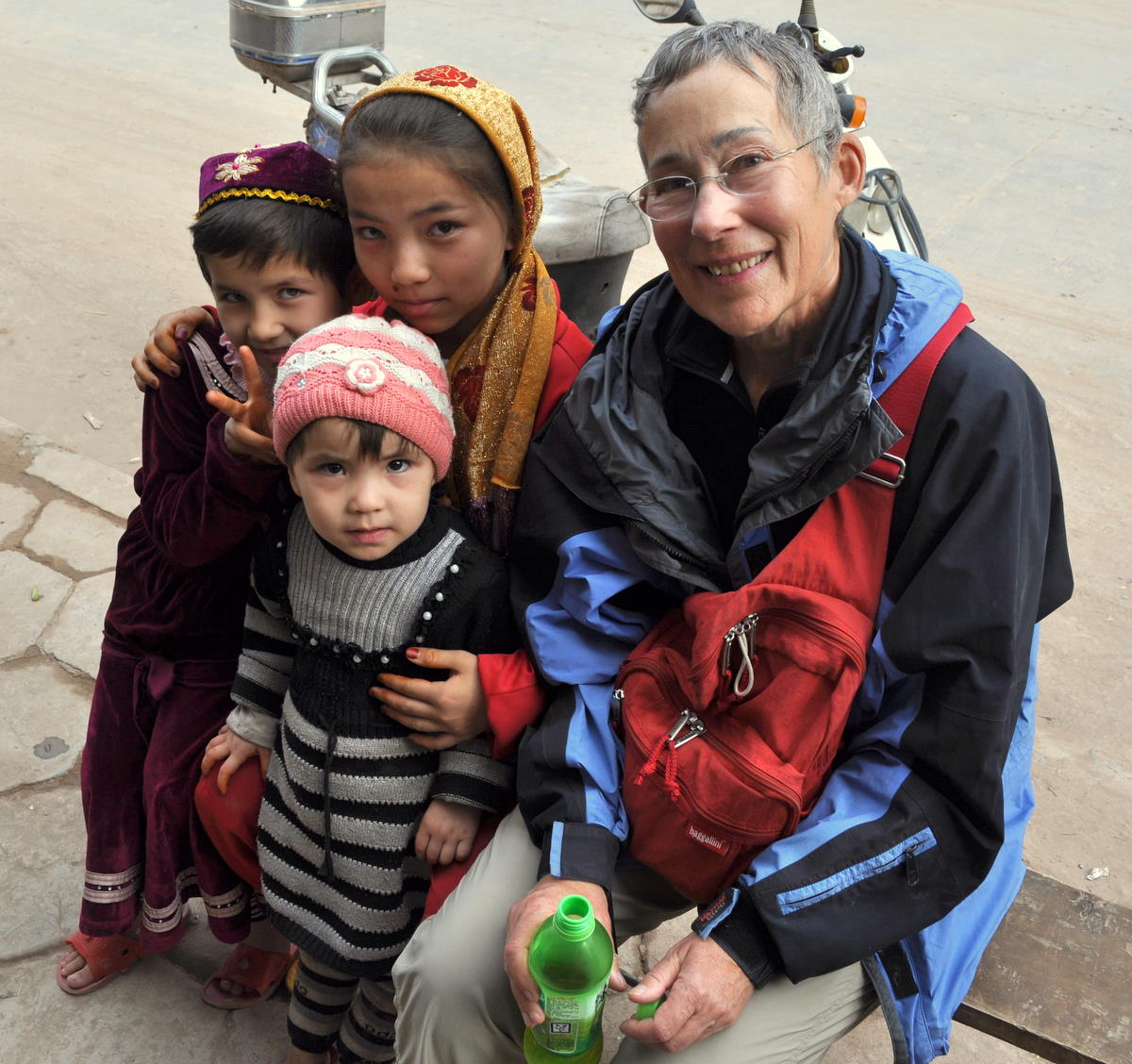
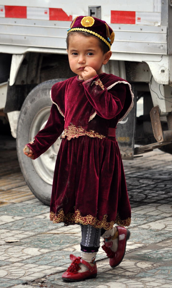
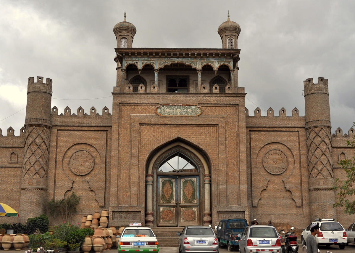
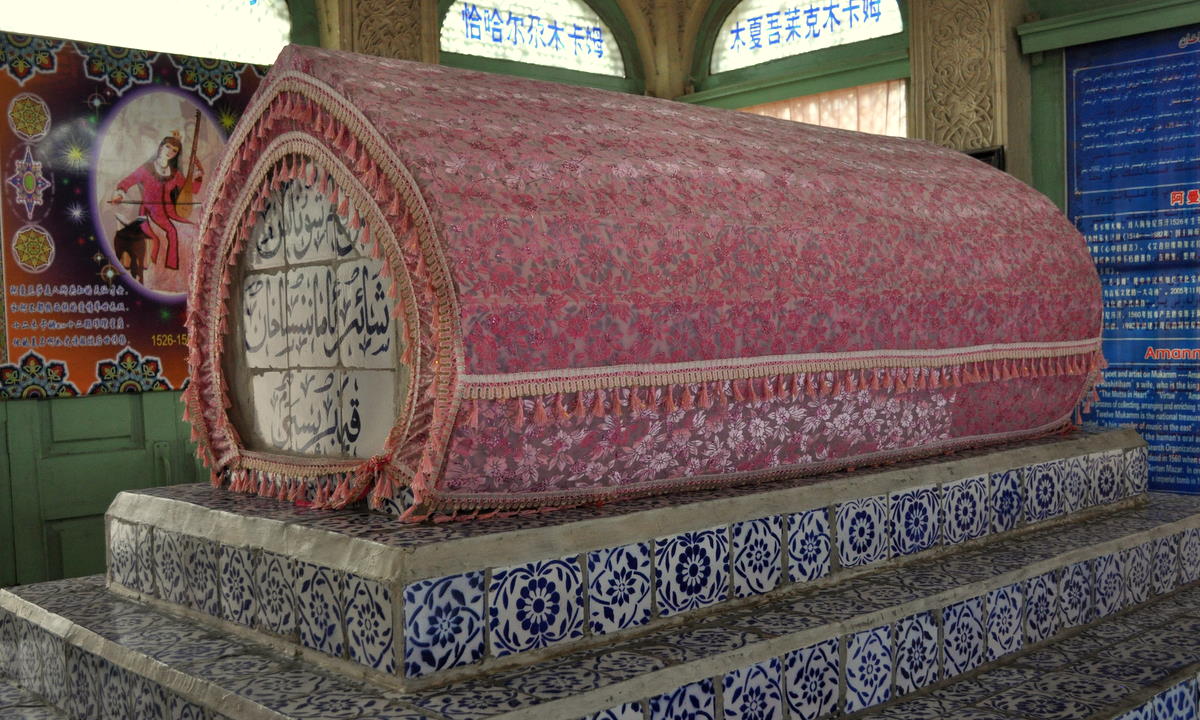
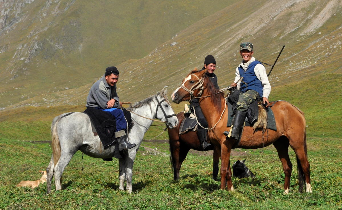
Of course not everything has changed. The 600-year-old Id Kah Mosque still stands in the center of town, and the Abakh Hoja Tomb and above-ground graveyard in its outskirts. Parts of the old town still remain, though falling into disrepair as the wrecking balls move closer. Storefronts and sidewalks are still crowded with vendors and repairmen, like the cobbler who restitched Marcia's boot for 1 yuan (15 cents in US currency). Uighur men and women still walk the streets in their hats, scarves and the occasional veil. Children still want their pictures taken. And everyone still ignores the Mao statue.


I met John Hu again. In 1987 he was just starting his cafe in a town where westerners attracted a crowd of 50 staring locals. He learned to cook pizza by asking travelers how to do it. This was a born entrepreneur and I knew he would go far. He now owns a chain of four cafes and tourist outfitters across Xinjiang and has just opened one in Lhasa.

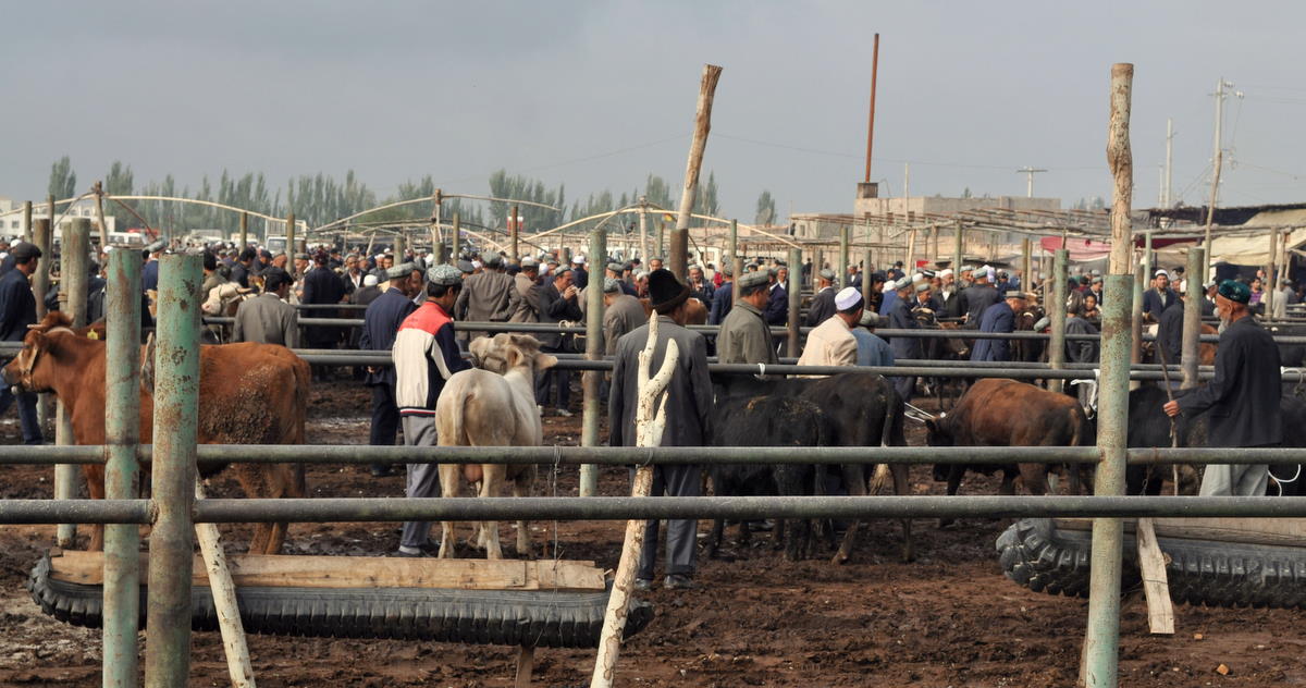
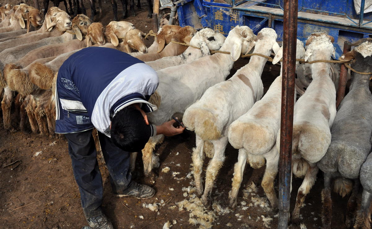
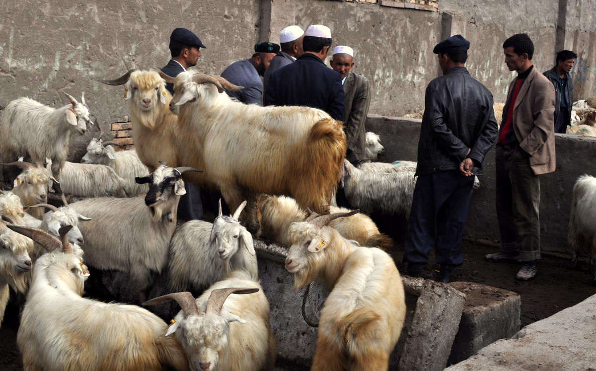
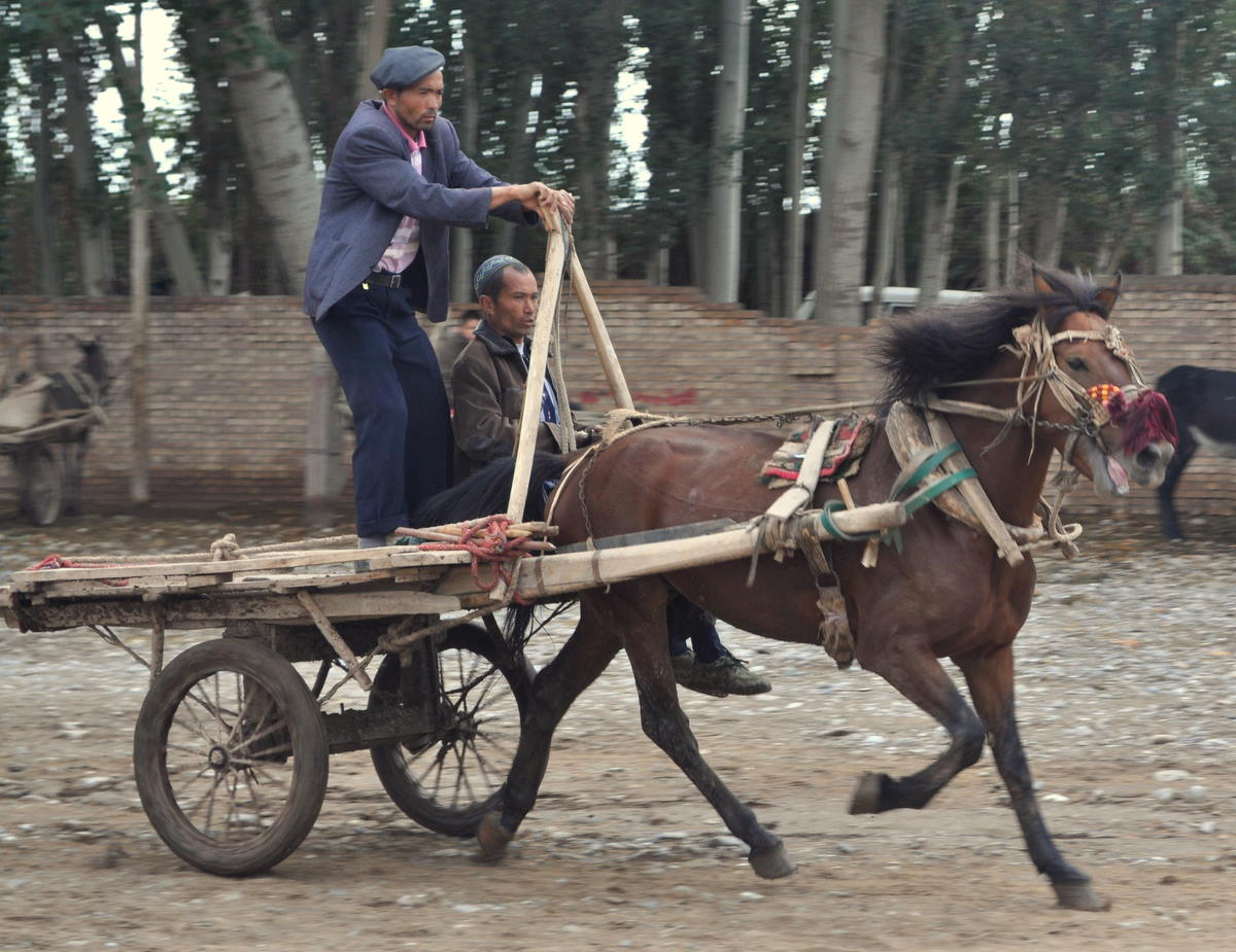
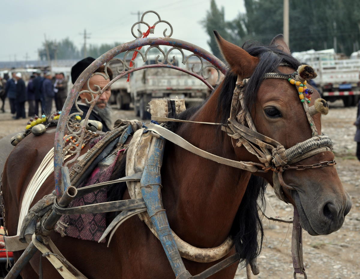
And Kashgar still has its Sunday Market, bigger than ever. It is so big, in fact, that they have split it in two, moving the animal market six kilometers out of town, where the fat-tailed sheep and horses can be displayed in a suitably muddy environment. Donkey and horse carts are still common there, and people wanting to buy a horse can take it for a test drive around the mayhem. It’s the Tsukiji of Central Asia.


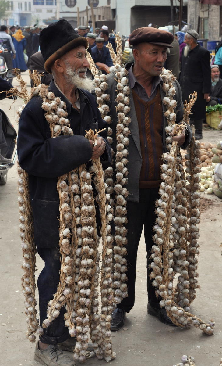
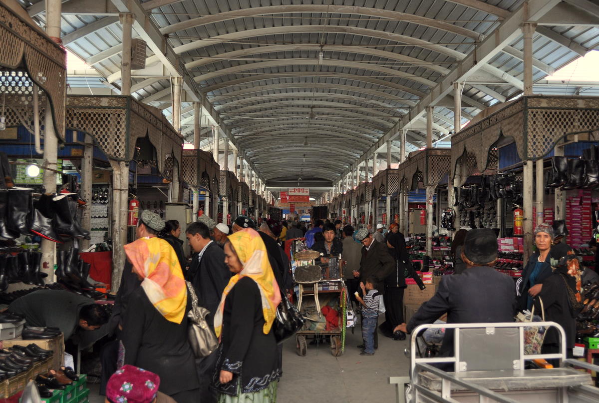
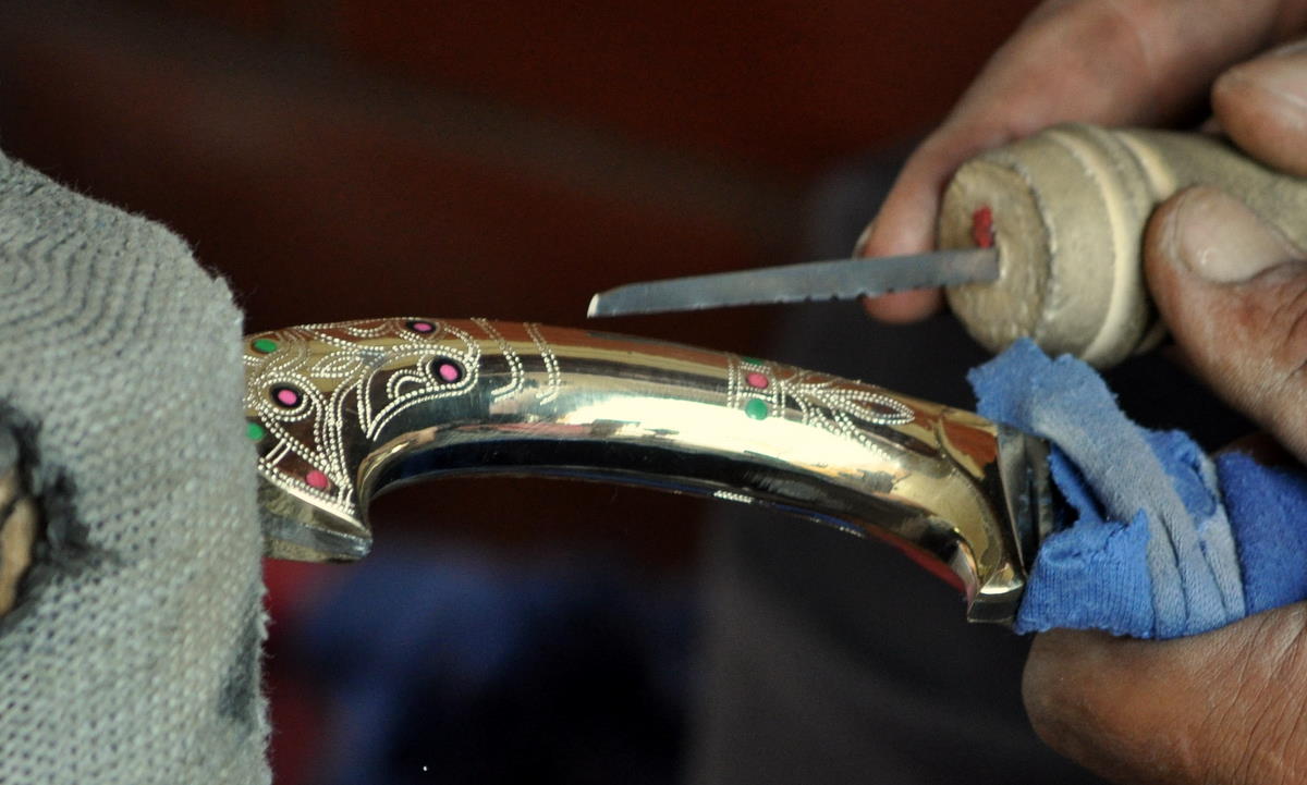
The regular Kashgar Sunday Market is the world’s largest flea market. All manner of clothes, rugs, hardware, and daily appliances are on display in almost a square kilometer of covered market, and the wares spread out into the surrounding streets. We were, however, somewhat disappointed at the selection of food, which we needed to buy for our time in Tajikistan, where supplies are reportedly limited. Food was limited to the staples of the local Uighur population and not much of it will travel well. We finally shopped at a grocery store in town.


So in a way I have now visited two cities called Kashgar. A different city in the same space but a different time. Who am I to say that the old mud houses were better for living than the new apartment blocks? Running water and sanitation are a good thing, and taxis are more comfortable than donkey carts. Time has been moving on for thousands of years here and it will again.

Signs in Kashgar

Chinese signs are often interesting, both for their content and their use of English.

The Chinese are obviously sensitive to the accusation that they are oppressing the local Uighur population, so they put the following heavy-handed propaganda at the end of an introduction to Kashgar’s mosque.


More amusing is the following sign on the back of the “tourist” urinals outside the mosque. I think the English is supposed to suggest that clients should stand close to avoid peeing on the floor. I can’t read the Uighur, but the Chinese is even more uplifting and reminiscent of Neil Armstrong’s first words on the moon. A slightly liberal translation would be “A small step forward to the urinal, a giant leap for mankind!”

Rain in the Taklamakan Desert

With five days to spare before we could cross back into Kyrgyzstan and Tajikistan, we decided to take a road trip to three smaller towns to the southeast of Kashgar. Yarkand, Yengisar and Karghilik (Yingjisha, Shache and Yecheng in Chinese) lie on the edge of the Taklamakan Desert a few hours bus ride from Kashgar, and life is still more traditional there. The train and superhighway won't reach here until next year.

For most of this time it was raining. The Taklamakan Desert is one of the driest places on earth, ranking with the Sahara as one of the only “true” deserts. But here it was raining, a monsoonal storm coming over the mountains from Ladakh and India. Dirt streets turned to mud and dry watercourses were close to overflowing.


We visited Yengisar first. Yengisar is known for its cottage industry of making the ornamental knives that every Uighur carries. Although some are now mass-produced, a few are still made by craftsman in small teams with few tools beyond a hand drill and grinder. The master of each team adds the decorative marks.

We then visited the smaller town of Karghilik. Again, the main part of town is a modern Chinese construction, but the mosque and mud-brick old town remains intact. Mud was flowing freely in the streets after the recent rain.


Finally, we visited Yarkand. Considerably larger, Yarkand was the northern end of the historical road over the Karakoram to Leh in Ladakh. That road is now closed and with it the trade with India. Although Yarkand has been considerably expanded by Chinese immigration, its old town is still thriving, with donkey carts mixing with electric vans. The mosque and former palace sit beside the tomb of Ammanisahan, a queen and composer of the classic Uighur musical collection. A group watched a street performer. A group of men prepared to send the casket of a loved one to the next world.


It is harder to find Chinese speakers in these smaller towns. In Kashgar, we could use our basic Chinese to order food and get around, but most of the locals here spoke only Uighur.

The most surprising place, however, was the Yarkand wangba (internet cafe). There is a large and rather rundown shopping arcade in the Chinese section near the bus station. On the mostly abandoned second floor are three huge rooms with a hundred computers each, open 24 hours a day mostly for teenagers playing games.

The Torugart Pass

After cleaning up and getting a good night's sleep in Karakol, we immediately needed to move on to our next destinations, the Torugart Pass and Kashgar, China. We would then cross back over another pass to the last mountain valley on the Kyrgyzstan-Tajikistan border. This roundabout route would get us to the Pamir mountains of Tajikistan without going through the troubled southern Kyrgyz cities of Osh and Jalalabad.

The Torugart Pass is legendary among Central Asian travelers, mostly because it can be very tricky to get across. Chinese bureaucracy says that the pass is only for local traffic, but they allow foreigners through provided they have prearranged transport on both sides of the pass. And the pass is closed on weekends and Chinese holidays, of which there are many in this season. So if we didn't get across on Tuesday the 21st, it would be almost a week before we would get another chance.

We spent most of Monday the 20th waiting for our Kyrgyzstan visa extensions. Without an extension, our one-month visas would expire on September 28. If all goes well, we will enter Tajikistan on that day, but it is unwise to assume all will go well in this part of the world. And it is even more unwise to overstay a visa, giving the corrupt police a reason to harass and demand bribes. So we applied and what should have been a ten-minute operation took most of the working day.

We finally got on the road at 4pm for the five-hour drive to Naryn, an overnight waypoint in the very center of Kyrgyzstan. Our route took us along the south short of Lake Issyk-Kol, the huge mountain lake that we had driven by on the way to Karakol. In addition to the lake, we passed many fine mountains and elaborate Kyrgyz cemeteries. The weather was superb this time, but it unfortunately got dark for the last mountainous stretch into Naryn.


We rose at 6 the next morning to drive to the pass. This part of Kyrgyzstan is high-desert basin-and-range country with broad valleys not unlike Nevada's. We passed but did not have time to visit the 15th-century caravansarai of Tash Rabat.


Kyrgyz exit formalities were straightforward, but the meeting at the pass was not. Neither Kyrgyz nor Chinese cars can cross the border, so both cars come to the pass and the foreigners walk across with their bags.

That's assuming both cars arrive. It was snowing and about 50 trucks were trying to cross the one-lane pass in both directions. The resulting gridlock shut down all movement for several hours. Our Chinese driver was stuck in the snow downhill.


I finally managed to call the Chinese driver on my cell phone and learned that he was ten minutes away. Once he arrived, we went immediately downhill towards Kashgar.

The Chinese border police chose my backpack to search. They gave me some trouble about my large collection of medicines, but ultimately had fun joking with me about the elementary Chinese books they found.

By the early evening we were in Kashgar.

Kyrgyzstan trek day-by-day

What follows are a series of day-by-day postings with descriptions and pictures of our trek in the Tian Shan (Heavenly Mountains) of Kyrgyzstan.

This was a trek like none other. This region of Kyrgyzstan is essentially uninhabited except for a few nomadic horsemen, so the area is mostly trailless wilderness. We saw no one outside our party for the last two thirds of the trip.

And yet the scenery was unsurpassed. The Tian Shan mountain range extends from Mongolia to Central Asia. In eastern Kyrgyzstan, it reaches its highest point with several peaks above 7000 meters (23,000 feet). Down from these mountains extends the 64-kilometer (40-mile) Inylchek Glacier, the third longest temperate mountain glacier in the world. This unique mountain area ranks with the Himalaya and Karakorum as one of the best in the world.

Most climbers go directly to the glacier on soviet-era helicopters that fly in July and August. Because we could not come until September, we arranged to take the long walk in across verdant hills and lower mountain passes. This gave us time to enjoy the broader Kyrgyz landscape and to get some superb mountain views. Less than 400 people take this route each year.

As before, I have organized the postings so they should follow in order. You will need to use the navigation pane or press the “Older postings” link at the bottom of each page to go through the complete list.

Day 1 – August 31 – Transport to the trailhead

We got a late start because of several technical problems I was having with my new satellite phone. In theory it was supposed to send and receive email, but the interface is so old-fashioned it was hard to figure it out. At one point, I made a change that prevented everything from working. I finally gave up and told people just to send text messages for now.

We had time, fortunately, because it was only a three-hour drive, even allowing for stops to throw water on the overheating engine of the Soviet-era military transport. In fact, we didn't need such a heavy vehicle for the trip out, since most of the road was paved and the dirt part at the end was well graded. We'll need it for the return trip, though.


The terrain was alpine, with wide glacial valleys and streams. The transition from desert to trees to alpine treeline was almost immediate.


The weather pattern seems somewhat regular. In the morning it tends to be clear and calm. As it warms up, the wind blows up the valleys from the lower elevations and clouds might build. By the mid-afternoon, the clouds might turn into thunderstorms, after which it becomes clear and cold. At night the wind reverses and blows back down the valleys. Daytime temperatures are warm (25 C = 77 F) and nights are near freezing. On the glacier later in the trip it could get down to -15 C = +5 F. Fortunately we brought our winter sleeping bags.

This is less of a five-star trip than we had in Ladakh or even Nepal. Marcia and I share an ultralight tent barely big enough for us and our stuff. There is no separate dining or toilet tent. The guide doubles as cook and prepares food over a backpacker's butane stove. We have only three porters and the guide to carry everything in huge expedition packs. A young woman interpreter rounds out the team but only carries her own stuff. The team consists of three ethnic Russians, one Kyrgyz, and one Tatar. They speak Russian amongst themselves, as is common in Kyrgyzstan.

Day 2 – Sept 1 – Our first pass

On our original plan, we had added an acclimatization day at the trailhead, because we were concerned about going from sea level straight to a 3200 meter (10,500 foot) camp and a 3700 meter (12,100 foot) pass. Marcia had some problems doing such things in both Nepal and Ladakh, so we wanted to be conservative. But of course, we had done the same thing many times without problems in the Sierras.

We were feeling fine except for minor headaches, so we decided to skip the acclimatization day and go straight over the pass. It was an easy climb and despite some breathlessness, we made it to the pass in two hours.


The terrain in this part of Kyrgyzstan is much less rugged than the Himalayas. The pass was just a rolling summit and the slopes on either side were gradual.

The harder part was actually the descent, because the grasses gave way to weeds that masked numerous animal holes. I took a spectacular spill on one place where my recovering left ankle gave way. Rather than risk a new injury to my foot, I took a hard fall on my body. No harm done, fortunately, but we moved even slower after that.

Hiking in Kyrgyzstan is essentially bushwhacking, with no established trails beyond an occasional faint track. Unlike Nepal or India, the population is low in Central Asia, especially so in the mountains. The few people living here are Kyrgyz horsemen nomads, who do not live in villages. And there are very few visitors. It reminded us of hiking in the Gates of the Arctic park in northern Alaska.


We made it to camp at 2pm just before the first thunderstorm hit. A group of Kyrgyz horsemen came by to show off the marmot they had shot. Our guide warned us to keep everything inside our tent, as thievery is common among poor nomads.

Day 3 – Sept 2 – Ashu-Tor Pass

Our task for today was to cross another 3700-meter (12,100 foot) pass into a different lateral valley still on the north side of the hills. It was an easy climb mostly up an abandoned jeep trail, though it seemed longer because we must have camped a little lower.


The weather was a problem. It was already cloudy when we awoke, and by noon a fairly big thunderstorm had already developed. Fortunately this one passed us to the north and allowed us to make it over the pass with only a few drops of rain. But once we sat down for some lunch on the other side of the pass, another storm hit and showered us with hail and rain. We covered up as well as we could and ate, but as the rain showed no sign of letting up, we were forced to hike the remaining six kilometers in the rain. Thankfully, the jeep trail continued most of the way and we could walk pretty quickly

Day 4 – Sept 3 – Another day, another pass

The next two days were to be devoted to crossing the mountains into the huge Saryjash valley to the south. To do this, we had to cross something marked Echkilitash Pass on the map. The elevation gain was about the same as the previous day, but the distance was longer. Some gonzo twenty-somethings do this all in one day, but our plan was to take two.

The weather looked bad. Although it was not raining when we awoke, the cloud cover was heavier than any day before. It looked like it could begin raining any moment and continue all day.

We held a council and reviewed our options. We had a spare day and could hole up in our tents if we wanted. But our guide and I both observed that such a weather pattern could continue for days. We could move camp about an hour across the valley, but we would still lose the day if we didn't make it to the pass. So we reluctantly agreed to continue through what promised to be a rainy day.

The team prepared breakfast and started to break camp. Just before our tents had to come down, a heavy cloudburst hit and we took shelter. It only lasted a few minutes, but we were pretty discouraged. Marcia would have abandoned the whole trip if she'd been given the choice.

We spent our first hour crossing to another side valley. This required us to wade two stream crossings in our sandals. On the slopes we were able to stay high and avoid too much elevation loss.

At the end of the second stream crossing, we observed some unexpected sunshine. A fairly large hole had opened to the north and we could even see some breaks in the clouds overhead. At first we dismissed it as a “sucker hole,” but when the clouds continued to break we thought it wise to apply sunscreen.


We climbed relentlessly along the side of a hill leading up to the ridge at the end of the valley. It was tough going and seemed longer than either of the two previous days. We finally reached the top right where the lateral hill met the ridge and were rewarded with our first view of the snow mountains of the Tian Shan to our south. The storm had now broken and left the air crystal clear.

We were shocked to hear our guide congratulate us on crossing “the first pass.” He assured us the second was only 40 minutes away, so we followed him thinking the true pass over the ridge would be just around the corner. Instead, he led us all the way down into the next lateral valley that still flowed north into Lake Issyk-Kol.

We were happy to see our porters coming back to look for us when we reached the bottom. They had crossed the lateral hill at a lower point and were wondering what was taking us so long. We were a bit annoyed that our guide had taken us over a needlessly high pass, but of course that gave us the chance to see the high mountains.

We camped in that valley rather than crossing the second pass. It was now bright sunshine and we could spread our things out to dry. Marcia was glad I hadn't given her the option to quit.